It is generally regarded that Railey Fell was (and still is) the area north of the River Gaunless within the Evenwood & Barony Parish. It included the rural area in the west from Lands; up to Windmill and beyond in the north, and eastwards to Toft Hill and Sloshes Lane, almost to Witton Castle and Phoenix Row. However, a plan not seen until recently, shows an area to the east which includes land to the east of Witton Castle, in the vicinity of Witton Park.[1]

Above: A 1753 plan showing Railey Fell drawn by Richard Richardson.
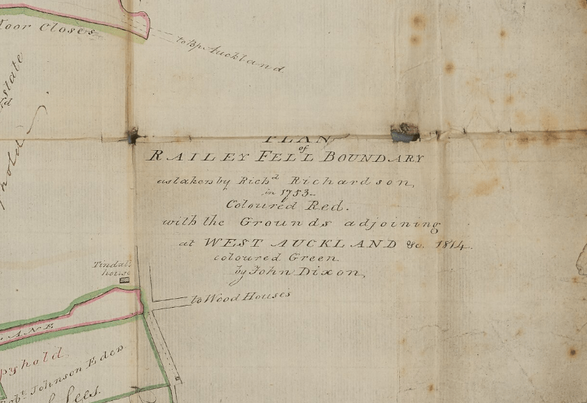
Above: 1753 Title Block

Above: A Detail to show the Witton Park area
The significance of this is that the location of the “ancient” Railey Fell Colliery, much referred to in early documents and leases, has not yet been identified.[2] It was previously thought that this Railey Fell Colliery was most likely to be Carterthorne Colliery located opposite the Sloshes Lane/A68 junction. This site was worked heavily in the late 1800s which may have obliterated earlier workings. However, there seems to be 2 other possibilities:
- There are many old shafts, pits and collieries in the Witton Park area which have numerous names – Phoenix Pit, Old Etherley Colliery (otherwise known as Jane Pit), Witton Park Old Colliery (otherwise known as William Pit), shafts to the north of Witton Park Farm, shafts at Old Pit Fold west of Witton Park Farm, old shafts in High Pot Hill Plantations – could one of these or a combination of workings, have been the original Railey Fell Colliery and renamed at a later date?

Above: A ticket head for the Old Etherley Colliery under the ownership of W. Stobart Junior & Company
- Ramshaw workings on Thomas Humphries’ land, identified on a Strathmore Plan is a less probable possibility.

Above: Title Block of the Strathmore Estates plan which shows Royalties on Railey Fell
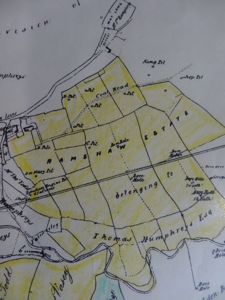
Above: The Ramshaw Estate on Thomas Humphries’ land showing old shafts & pits
SOME OBSERVATIONS
Richardson’s 1753 plan identifies the locations of 2 other coal workings:
- Lynburne and Rowntree pits
- Butterknowle Pits


Also, there are 2 historic features mentioned in the Carterthorne lease of 1714 which are identified by the Richardson plan
- Evenwood Park Walls (see above plan)
- Hurrock of Stones at the Height of Butterknowle

REFERENCES
[1] Durham University Library, Archives and Special Collections. Durham Bishopric Halmote Court Records: Court and miscellaneous books, reference: DHC11/VI/57a 1814 Plan of Railey Fell Boundary as taken by Richard Richardson in 1753 with grounds adjoining at West Auckland etc.
https://reed.dur.ac.uk/xtf/view?docId=ark/32150_s19s1616170.xml#qxj-3311
[2] There are plans kept by the Coal Authority which, no doubt, will confirm the location of the “ancient” Railey Fell Colliery but ER&DHS has not seen such plans. Perhaps we should contact the Coal Authority for assistance.
