Within the Railey Fell lease, an extensive review of information held by the Coal Authority, particularly the catalogue of abandoned mines, would be required to accurately map out the sinking of drifts/shafts and their closure. The Stobart Coal Company worked the area over many years and the closure of West Tees Colliery at Ramshaw in about 1938, saw the end of the company’s association with the area. After nationalisation in 1947, it is believed that a number small private concerns such as the Gordon Bank Coal Co., opened up some of the abandoned drifts as Licensed Mines.
Any information concerning the tramways, drifts and mines would be appreciated.
About 1938: It is believed that the full extent of the Railey Fell/West Tees Colliery tramway reached up to the Martinfield Drift, located on Hunters Lane.

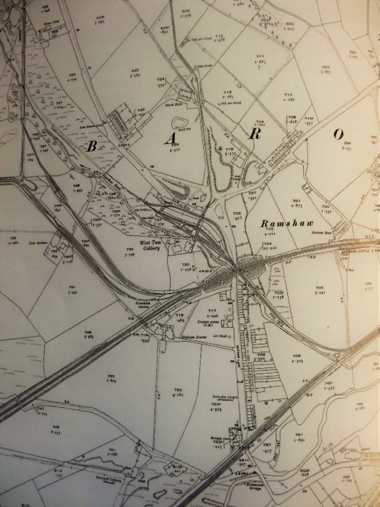
About 1898: The Ordnance Survey map shows the railway branching off the Haggerleases Line east of Gordon Gill to serve West Tees Colliery, the coke ovens and screens. There are 2 tramways beyond the colliery:
- Followed Gordon Gill to 2 drifts to the north west.
- Another served Sand Hole drift to the north and entered the pit yard and the screens at high level.
This map shows a disused tramway which connected West Tees Colliery to Lands Colliery to the west. The actual route is difficult to locate on site.

About 1921: This map shows the Sandhole tramway extended further northwards, to a drift on Gordon Bank.
Below: Sandhole Drift

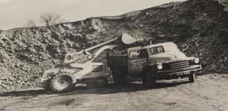
Below: 1939: Railey Fell/West Tees Colliery after closure (Ada Temple photo)

Below: Sandhole pitheap

Below: Reclamation of Sandhole pitheap