Many will have noticed metal detectorists in the fields along the New Road during November and December. They are the Durham Dirt Diggers [1] and having secured permission from the land owners, found a variety of artefacts. Numerous coins such as an Edward I penny and other objects such as a cannon ball, paupers’ rings, lead spindle whorls, miners’ tub tallies, musket balls, military badges and buttons were unearthed.
This brief account will summarise the finds.

Above: A fine day in November 2025, the Durham Dirt Diggers get to work
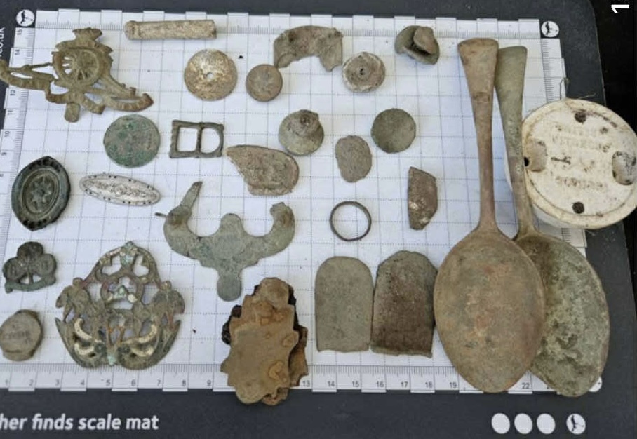
Above: A selection of finds from Evenwood
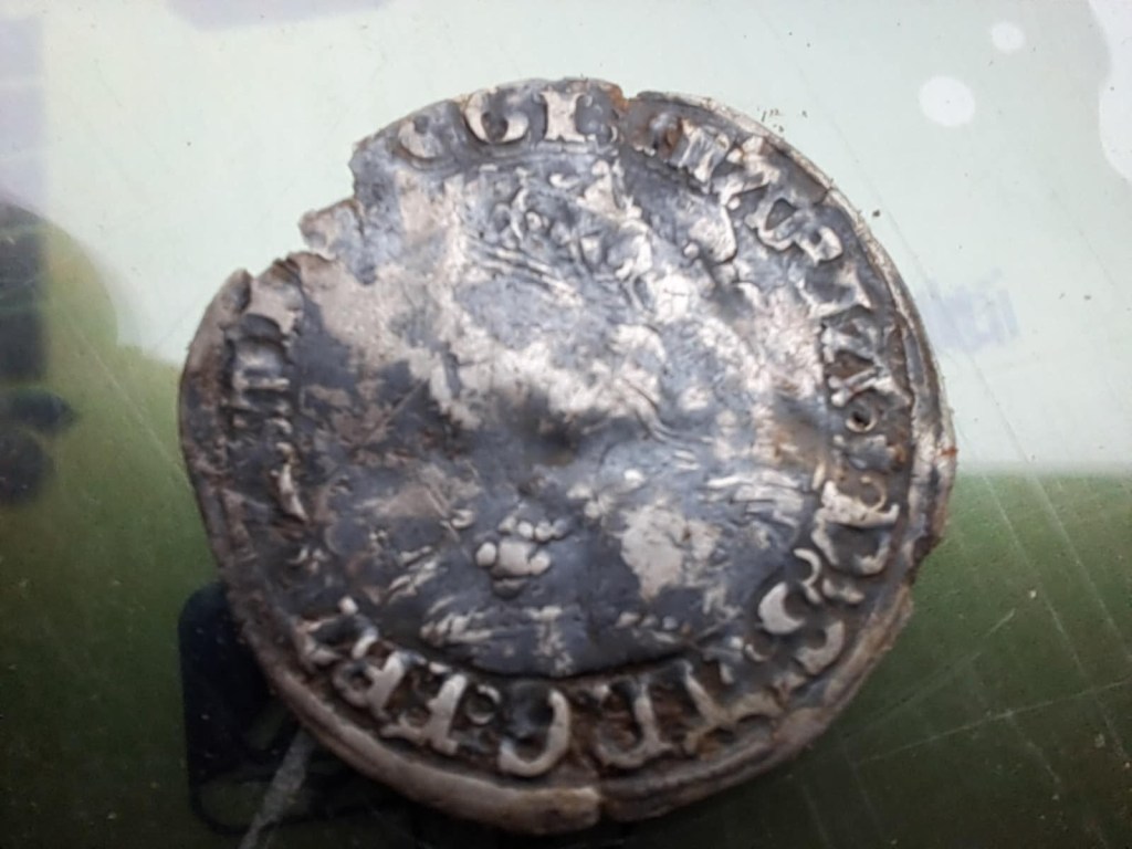
EDWARD I HAMMERHEAD SILVER PENNY [2]
Edward I (1272–1307) hammered silver pennies, often called “Long Cross” pennies, are common medieval coins, typically 18-19mm in diameter and weigh approximately 1.3 to 1.4 grams. The obverse usually features a stylized portrait of the King, while the reverse features a long cross with three pellets in each corner. The legends are abbreviated versions of EDWARDVS REX ANGLIE DOMINVS HYBERNIE.
They were produced with a “long cross” design extending to the edge of the coin on the reverse to prevent clipping. This coin was found north east of Park House Farm.
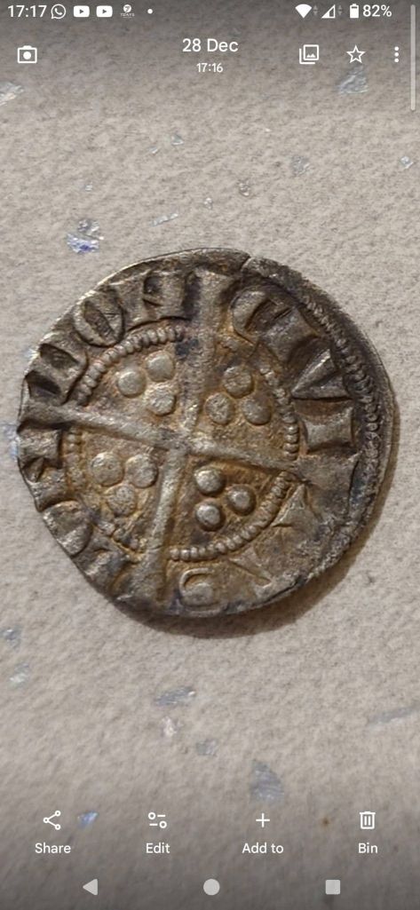
Images courtesy of Jordan Blakey
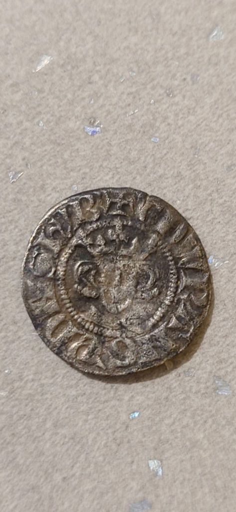
A JETTON [3]
The Jetton was an alternative to currency. They were produced in copper alloy and used to perform calculations for accountancy and were in common use from the 13th to 16th centuries. The early types include those based on Edwardian long cross pennies. French Jetton, many carrying a “fleur de lys” design, are increasingly common finds from the 15th century. An enormous array of types produced in Nuremberg became the most common types in the 16th century, of which a design based around a rose and orb are amongst the most frequently found.

Image courtesy of Jordan Blakey
MARY TUDOR GROAT [4]
A groat is a 4 penny piece. Prior to her marriage to Philip of Spain, Mary I coins (1553- 1554) had the inscription VERITAS TEMPORIS FILIA on the reverse. This translates as “Truth, the daughter of Time” and is only found on the coins of Mary Tudor. This coin was found in a field to the west of the site of the former Kays Hall Farm.
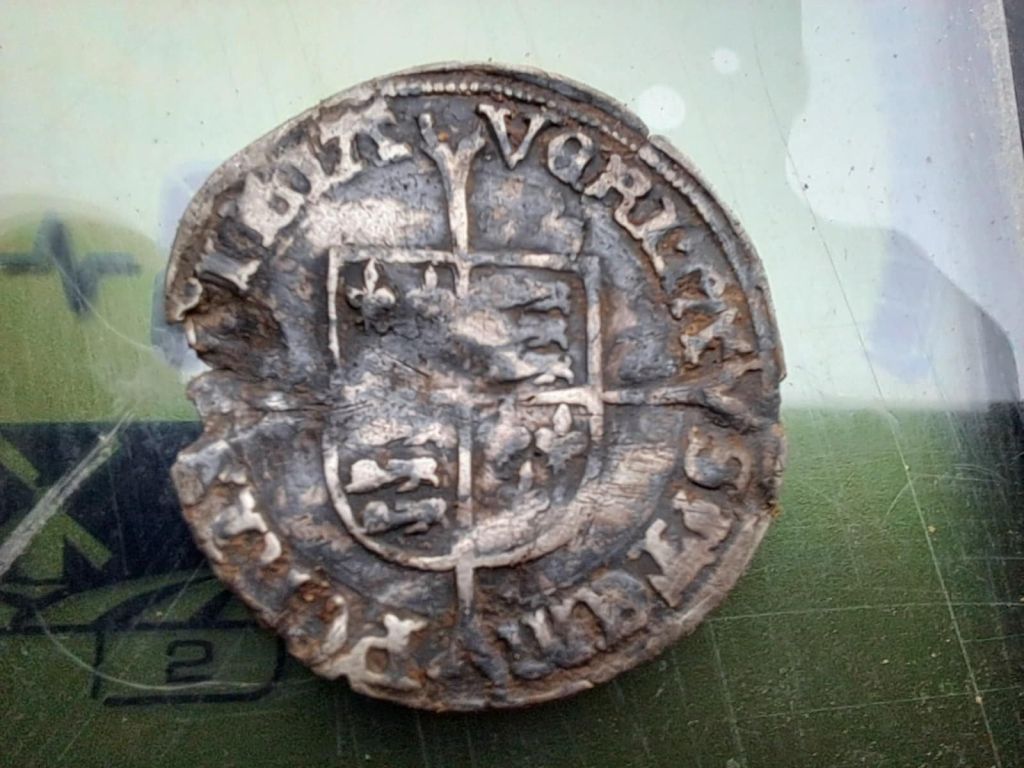
Images courtesy of Jordan Blakey
LEAD SPINDLE WHORLS [5]
Lead spindle whorls are small, perforated weights used to add momentum to drop spindles for spinning fibres into yarn. Common in Great Britain from the Iron Age through the Roman, Viking, and Medieval periods, they were typically made from lead due to its ease of smelting and low melting point. These objects are usually flat/convex discs, sometimes featuring decorations, and were essential tools for textile production.
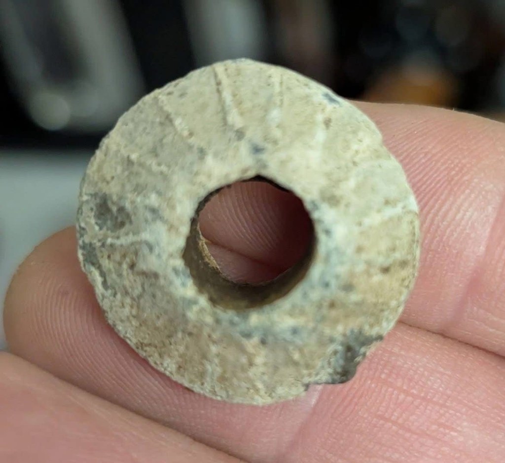
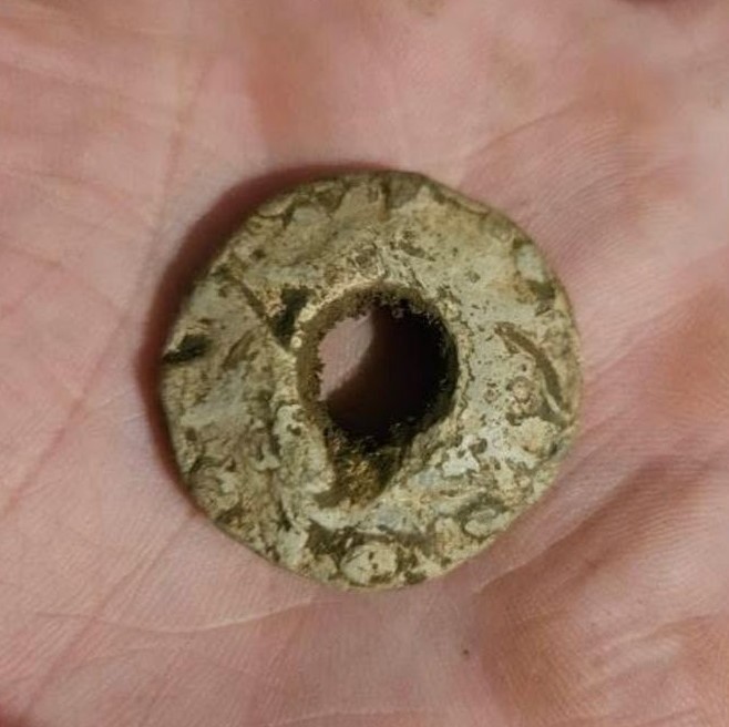
Images courtesy of Jordan Blakey
A CANNONBALL
This cannonball was found in a field east of Park House Farm. It is understood that others were found near to Buckhead Farm when the area was “opencasted” during 1980s.
During the English Civil War, the North East generally saw skirmishes and Scottish occupation but few major battles. The manorial site at Evenwood, the Barony Hall, [6] was reportedly bombarded by Oliver Cromwell’s Parliamentarian forces. Cannonballs have been found in the area.
Parliamentarian Action: Local tradition states that Cromwell’s Roundhead forces built a hill near the village to place a cannon, which was used to bombard the manor or castle.
Physical Evidence: The discovery of cannonballs in the vicinity of Buck Head Farm, a hill less than a mile southwest of the manor site, supports the account of a bombardment.
Condition of the Manor: A 1646 Parliamentary survey reported that the “goodly house, called the Barony” was “utterly decayed, and has so been for many years”. The derelict buildings were eventually demolished in 1826.
Regional Context: The broader County Durham and Northumberland areas were occupied by the Scottish Army for a significant period during the war, bringing hardship to local residents. While the North East was a Royalist stronghold, with supplies for the King landed in Newcastle, most of the major battles in the region were focused on key crossing points of the River Tees and major cities like York.
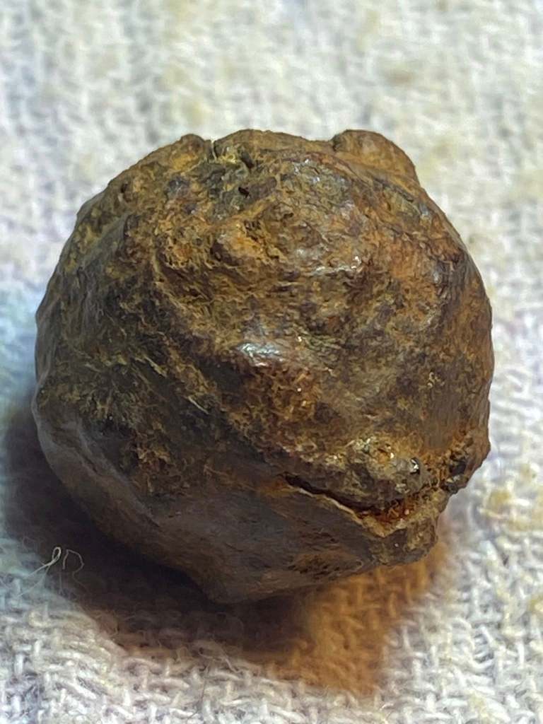
Image courtesy of Lesley Parratt
GEORGE III HALF PENNY 1766
George III reigned from 1760 to 1820. This is a copper coin, 7.4 grams.
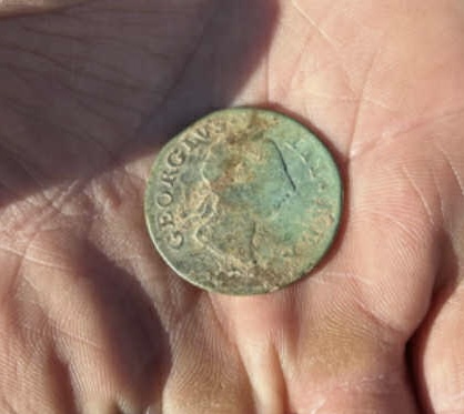

Image courtesy of Jordan Blakey
QUEEN VICTORIA 1889 (VEIL HEAD) SILVER SHILLING [7]
The obverse features the crowned bust of Queen Victoria, facing left with legend around. It is often referred to as the Jubilee Head or the “veil head.” The reverse features the crowned Royal Shield within Garter, with divided date below. The silver shilling coin, has a diameter of 23.5mm, weighs 5.63 grams.
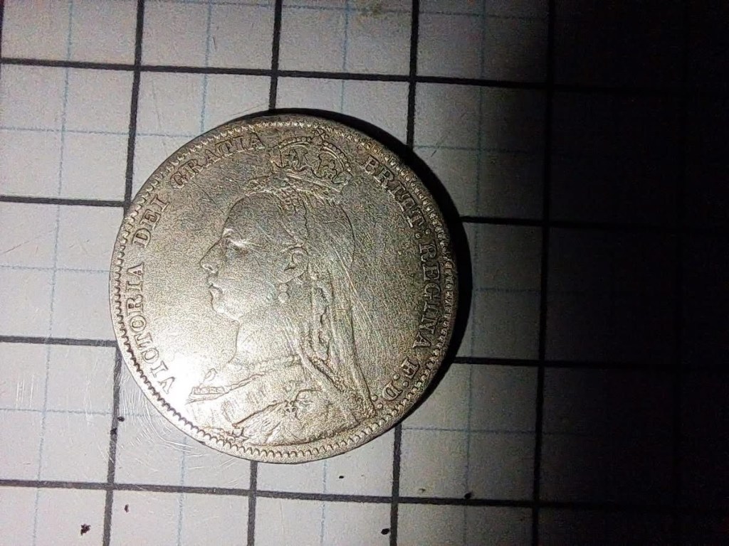
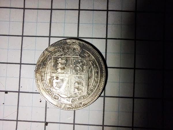
Images courtesy of Jordan Blakey
A PAUPER’S RING
The term, “Pauper’s Ring” is given to wedding rings of little financial worth, usually copper or some other metal of alloy. They are difficult to date. A number of these rings were found.

Images courtesy of Jordan Blakey
ROYAL NAVY BUTTON
Believed to date from 1902-1953, a Royal Navy uniform button with the crown, anchor and roped edge design.
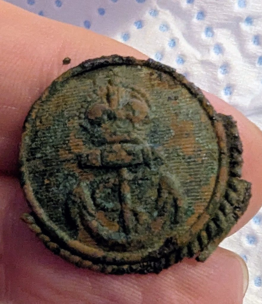
Image courtesy of Gemma Watson
ROYAL ARTILLERY CAP BADGE
This Royal Artillery cap badge looks as though it is the “economy edition”.
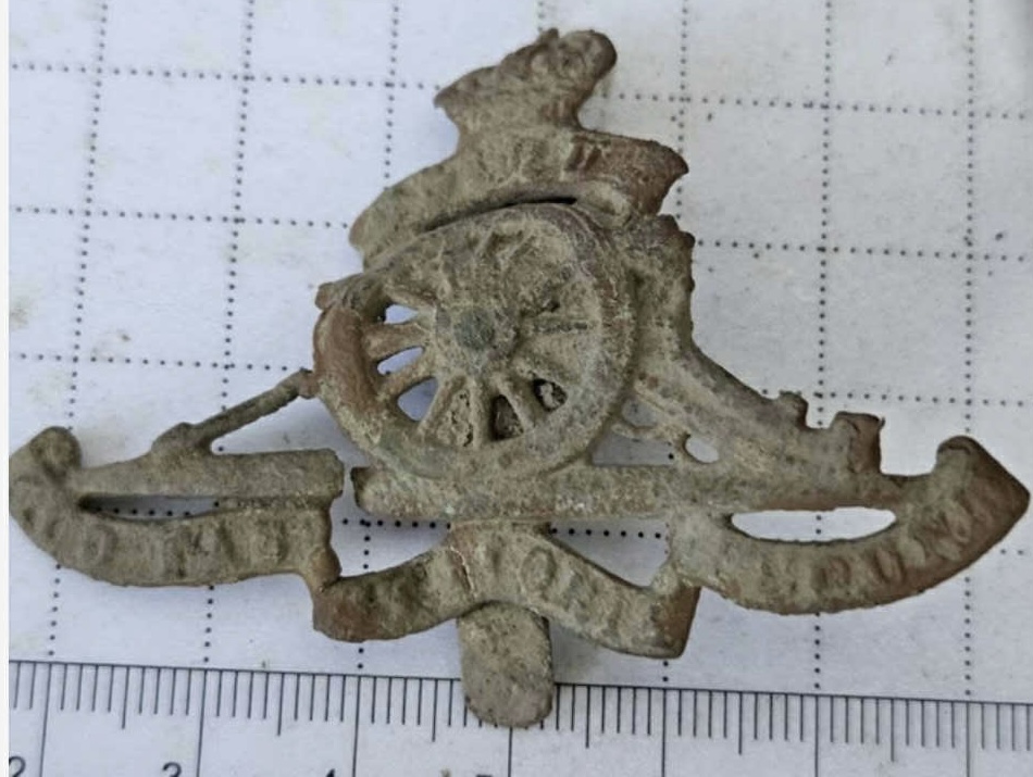
Image courtesy of Connor Macmillan
YORK AND LANCASTER REGIMENT CAP BADGE
There are 3 regiments with the tiger emblem, York & Lancaster, Leicestershire and Hampshire. The Y&LR is distinctive because there is a rose and crown above the tiger and its tail coils above its hind quarters. The example below is considered to be from the York and Lancaster Regiment.
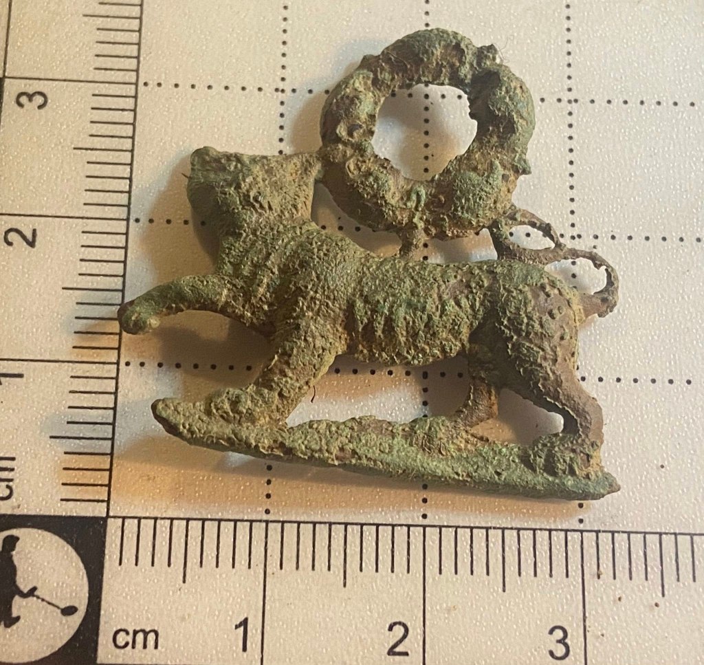
Image courtesy of Lesley Parratt
ROYAL SUSSEX REGIMENT
This is a distinctive design.
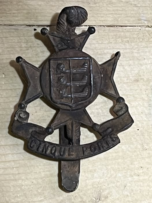
Image courtesy of Pawal Szeremeta
UNKNOWN BADGE
This badge could be from the Voluntary Reserve, an organisation which predated the Territorial Force introduced in 1908.
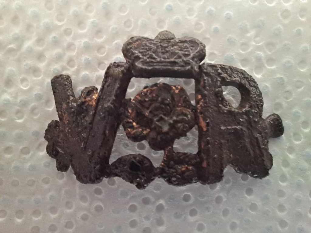
Image courtesy of Chris Smith
DURHAM MINERS’ ASSOCIATION TOKEN
The DMA was formed in 1869 and dissolved in 2018. At its height, in 1907, the union represented 105,612 of the County’s pitmen. Its HQ was at Redhills, Durham. The DMA Lodge at Evenwood was the local branch. It is understood that tokens were worn by members when attending union meetings. It is thought that Evenwood Colliery was originally located at Thrushwood where sinking commenced in 1833. A new winning, also called Evenwood Colliery, was sunk about 1851/2 in Cragg Wood. The colliery ceased working in 1895. Tokens such as this were used between 1868 and 1895.
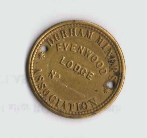
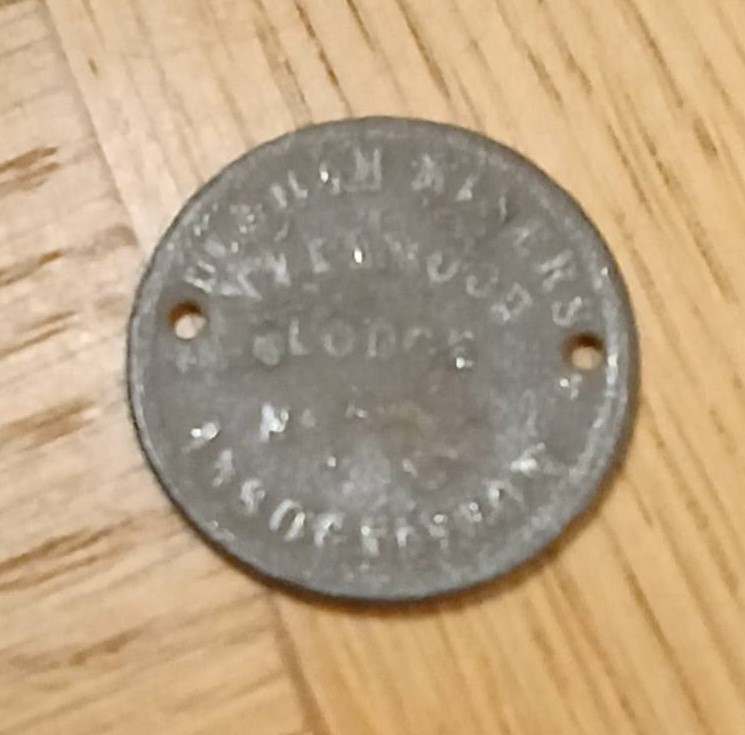
Images courtesy of Evenwood, Ramshaw and District History Society (TOP) and Billy Wright (BOTTOM)
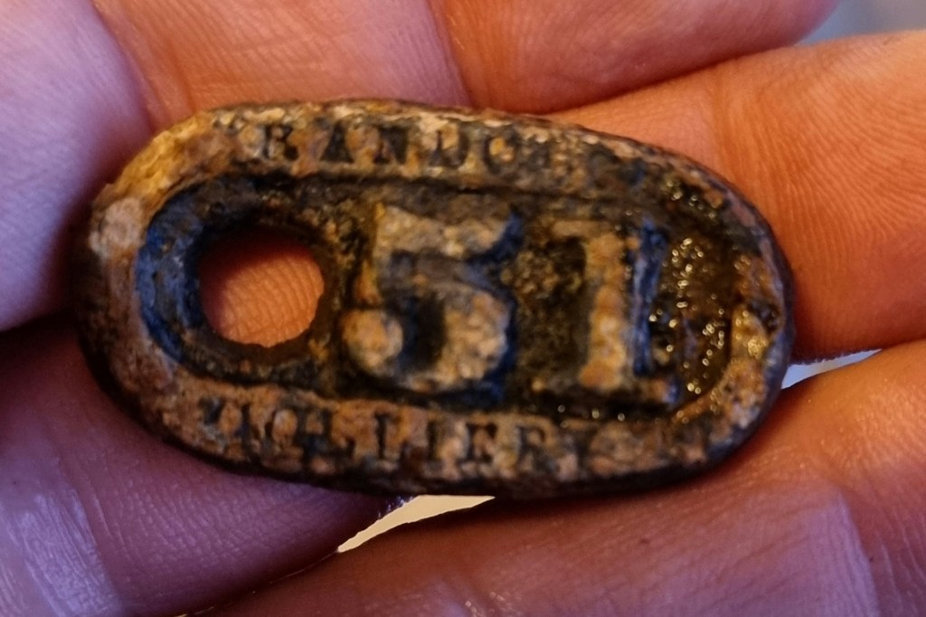
MINERS’ PIT TUB TALLIES
Prior to the nationalisation of the coal industry in 1947, pitmen employed as “hewers” worked together with “putters.” The hewers dug out the coal and the putters loaded it into tubs for transportation out of the mine. The men were paid by the amount of coal dug and they divided their hard earned wages with their “marras.” The coal tubs were identified with by a numbered metal tally attached to the tub. The number related to a specific hewer. The tubs were weighed by a checkweighman – one for the men and one for the company. Below are a number of tub tallies, number 51 is marked Randolph Colliery.
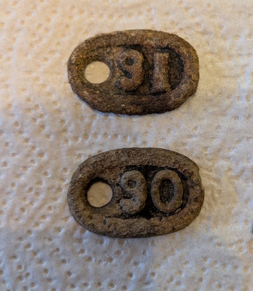
Image courtesy of Graham Sky
Images courtesy of Paul Atoc
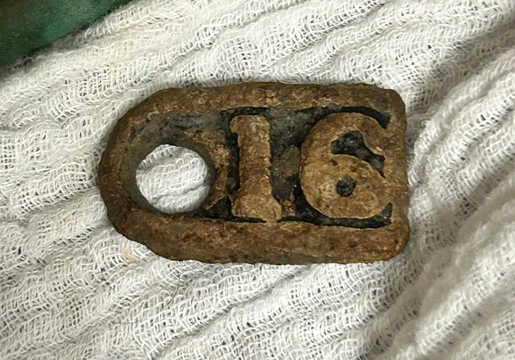
Image courtesy of Michael Warden
REFERENCES
[1] We’re a friendly County Durham metal detecting group for all levels – from beginners to seasoned diggers. Share your finds, swap tips, join meet-ups, and enjoy the hunt while respecting the land and history beneath our feet. Beep, dig, discover – and have fun! Facebook Group – https://www.facebook.com/groups/1451729535904873/
[2] https://www.google.com/search?q=EDWARD+I+(1272-1307)+Silver+hammerhead+coin
[3] https://finds.org.uk/volunteerrecording/guide/tokensandjettons
[4] https://archaeologydataservice.ac.uk/data
[5] https://www.google.com/search?q=lead+spindle+whorls
[6] Referred to as, “a goodly house” in the 1646 Parliamentary Survey (quoted by Conyers Surtees). Cartographers of the 18th and 19th centuries published County maps which showed the village of Evenwood. Some maps contained the notation, “Evenwood Castle in ruins,” and some clearly show the green as a feature. It seems that the “goodly house”, referred to in the Parliamentary Survey could have been the ruined castle indicated on some of these County maps. Evidence of the ruined castle is provided by the Earl of Strathmore’s Estates Map dated 1790 (surveyed by Parkins). It shows an area of land to the north of Evenwood which Strathmore leased from the Bishop of Durham. The following notation is included on the plan:
- The Mote
- Foundations of Evenwood Castle
[7] https://dorsetcoincompany.co.uk/product/1889-silver-shilling-small-head-victoria-jubilee-head
