Randolph Colliery and Coke Works was served by the S & DR Haggerleases Branch Railway, later known as the NER Butterknowle Branch. A self-acting incline 1260 yards in length was worked by a stationary engine which took waggons down to the railway. In 1962, the drum house was converted from a self-acting incline to be fitted with a 70 HP electric hauler.After 3 September 1963 when the Evenwood to Butterknowle section of the Haggerleases Branch closed, it was served by the remaining branch from the Tunnel Junction to Evenwood. This branch closed in August 1968.
Below: The route of the Randolph Incline from the colliery and coke works yard to the railway branch line.
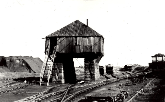
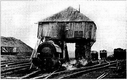
Below: The drum house at the top of the Randolph Incline.
Below: View down the incline showing the bridge over Copeland road and pit heaps.

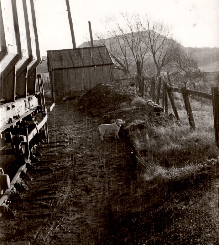
Below: 2 photos looking up the Incline

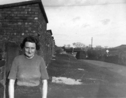
Below: Mrs. Hamilton of Copeland Row and the bridge over Copeland road in the background
The following locomotives were operated at Randolph:
- Carbon built 1866 ex-Gordon House, disposal unknown
- Mostyn built 1906 to Bear Park Coal & Coke Co. Ltd. East Hedleyhope Colliery April 1945
- Hustler built 1913 ex North Bitchburn Colliery scrapped by NCB?
- 7043 Randolph built 1942
- 7159 Winston built 1945
Both Randolph and Winston went to Randolph Coke & Chemical Co. Ltd. and were removed for scrap Autumn 1969 by C. Herring & Sons Ltd of Hartlepool.
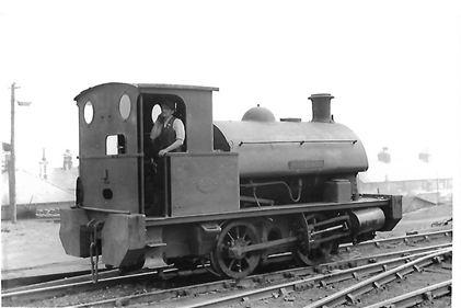
Below: The drum house with 7159 Winston shunting in the foreground.
A Mountford photo taken 7 August 1966.
Below: 2 photos of 7043 Randolph

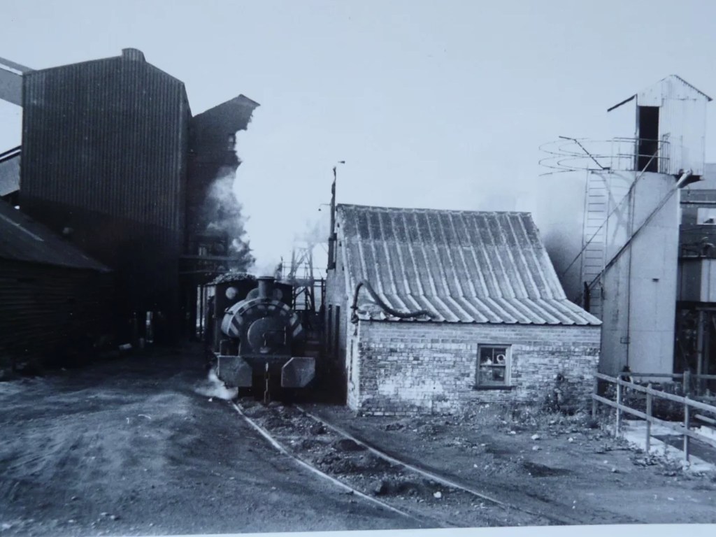
Below: 3 photos of Randolph in the Coke Works yard


Randolph loco men were John Truman and George Parkin.
SOME HISTORIC MAPS
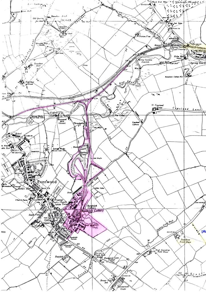
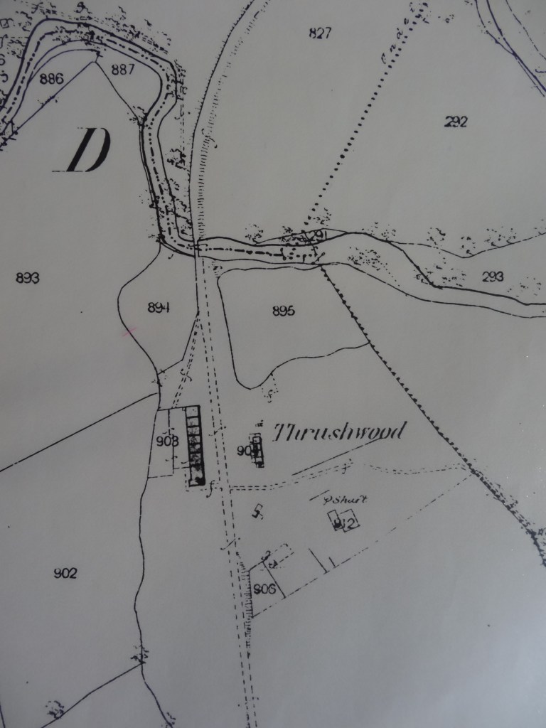
Below: 1859: The 1st Ordnance Survey Sheet (surveyed in 1857, published 1859) shows a potential route to the Haggerleases Branch Line leading from the pit shaft at Thrushwood. This pit was called EVENWOOD COLLIERY on the 1850 and 1852 maps by Bell.
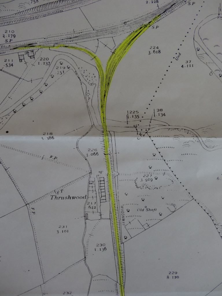
Below: 1898: The 2nd OS map shows the incline from the branch line to the colliery yard. It is noted as, “wagonway”. This plan shows the northern section where it bridges the River Gaunless. The pit at Thrushwood is marked, “old shaft”.
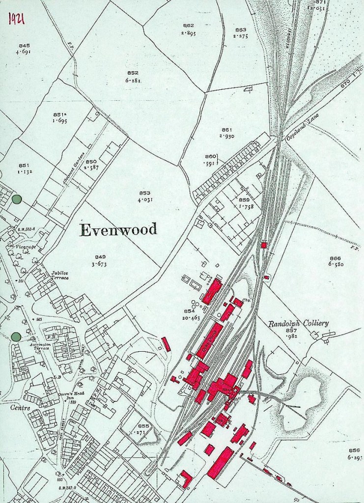
Below: About 1921: The 3rd OS Sheet showing the Randolph Colliery yard and coke works, the southern section of the incline, the drum house and bridge over Copeland Road.
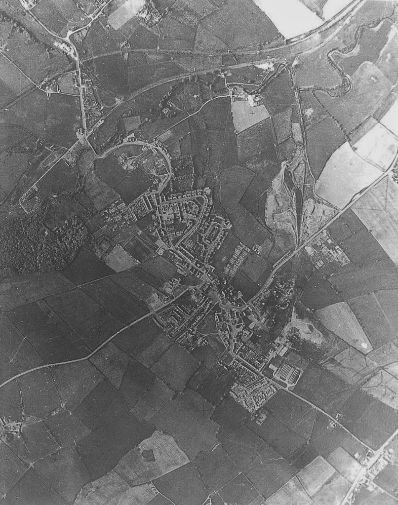
Below: about 1973: An aerial view of the Evenwood & Ramshaw area which shows the Randolph Coke Works, the Incline and pit heaps.
Below: about 1984: The coke works had closed but no reclamation had commenced. The incline wagonway ran between the pit heaps.

SOME PHOTOS TAKEN MAY 2023
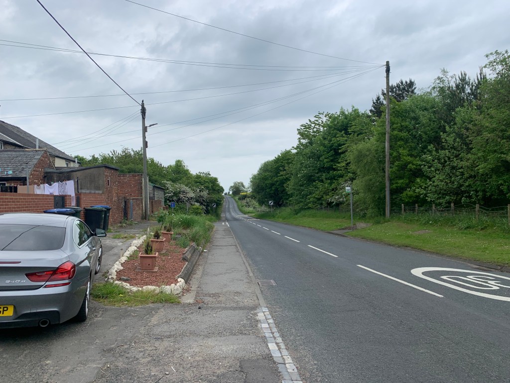
Below: Copeland Row looking eastwards towards West Auckland and the location of the bridge. It was positioned over the dip of the road.
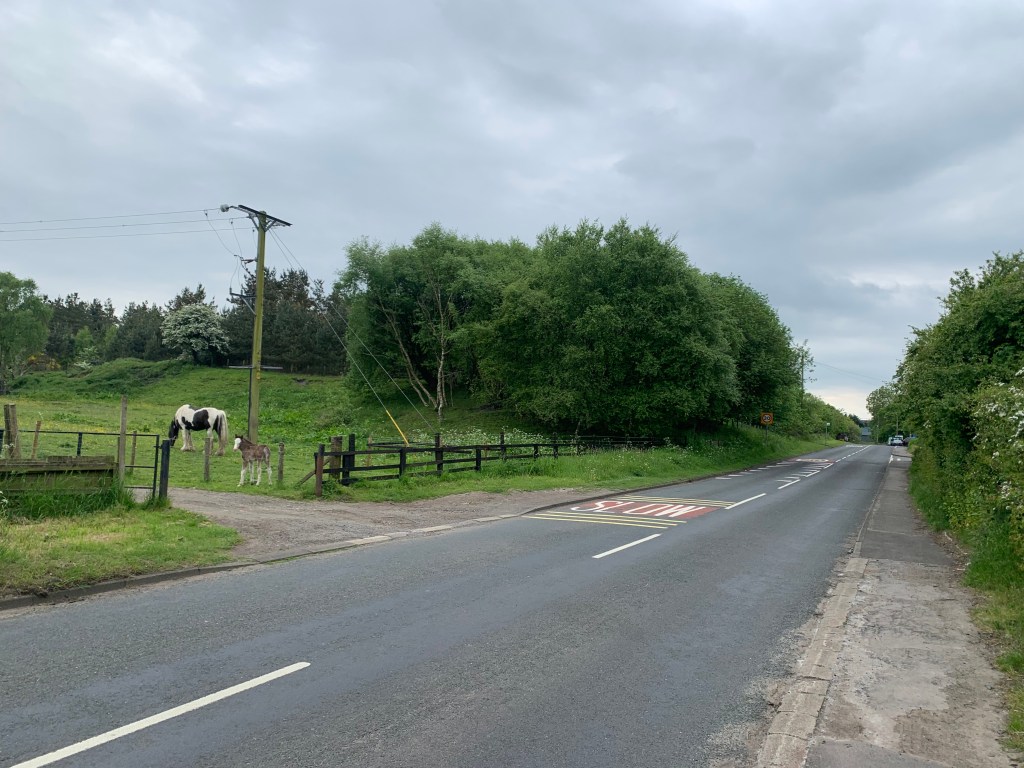
Below: Copeland Lane, looking westwards towards Evenwood towards the position of the old bridge.
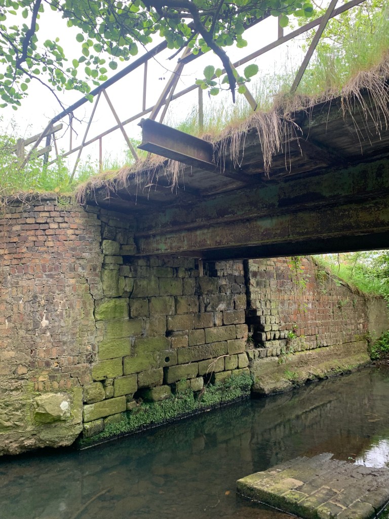
Below: The incline bridge over the River Gaunless.

Below: The bridge from the south.
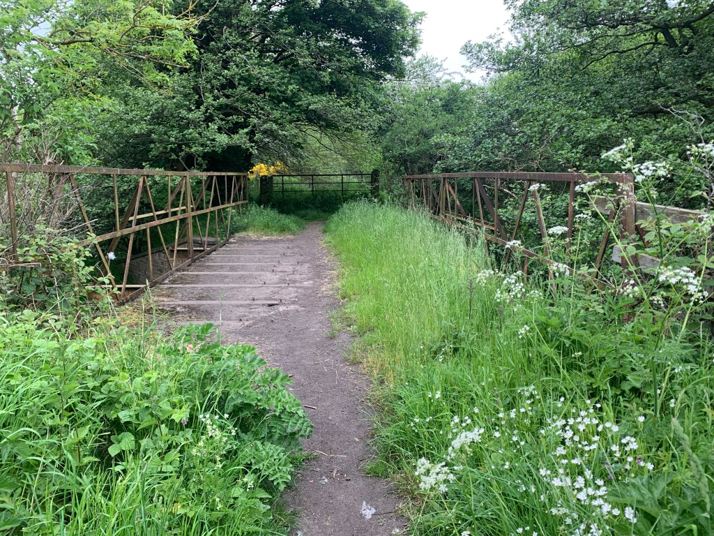
Below: The bridge from the north.

Below: Another views of the bridge. It was built by the Randolph Colliery tradesmen which included Ronnie Peddelty who was the colliery blacksmith. Ronnie is 99 years young, a former resident of Copeland Row and lives at Fairfield, Evenwood (May 2023).