THE STOCKTON & DARLINGTON RAILWAY CO: THE COMPANY SEAL

THE PHOENIX PIT, WITTON PARK – “Phoenix” implies, “Rising from the ashes” therefore do we assume there was an earlier pit on this site?

THE COAL DROPS AT STOCKTON-ON-TEES
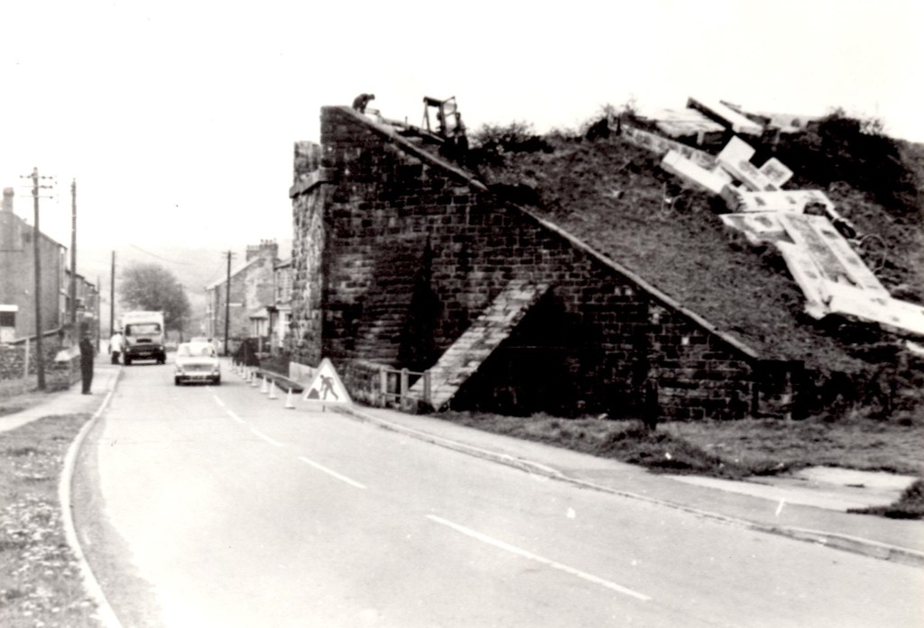
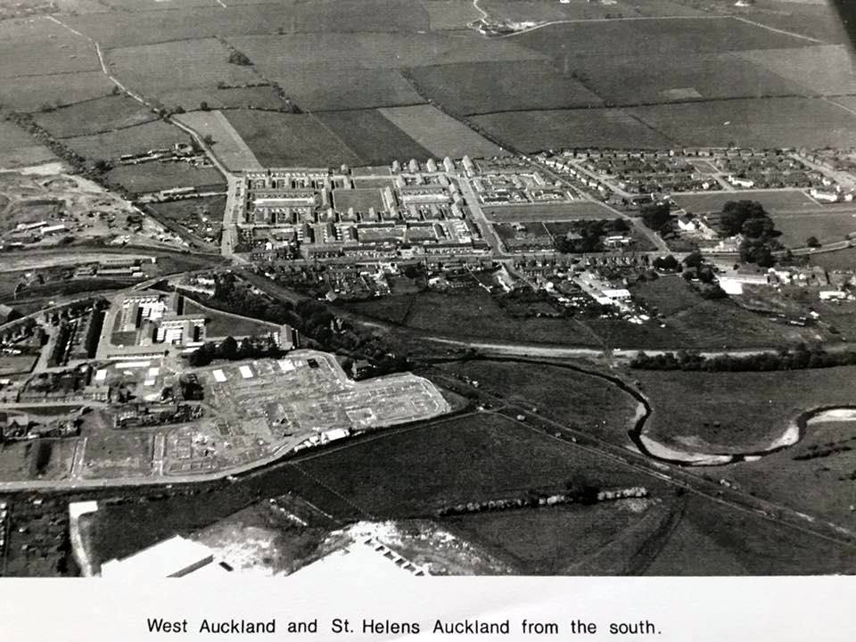
WEST AUCKLAND & ST. HELENS AUCKLAND – THE TRACK OF THE ETHERLEY INCLINE CAN BE SEEN TO THE LEFT MAKING ITS WAY UP TO THE HILLSIDE AND TO THE BOTTOM RIGHT ALONG BY THE RIVER GAUNLESS. THE PHOTO WAS TAKEN LATE 1960S WHEN THE COUNCIL HOUSES AT EAST GREEN, WEST AUCKLAND WERE BEING BUILT
2 PHOTOS OF WEST AUCKLAND RAILWAY CROSSING
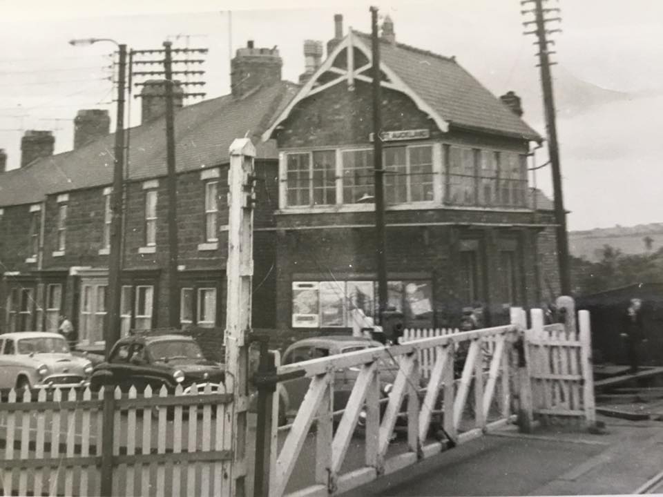
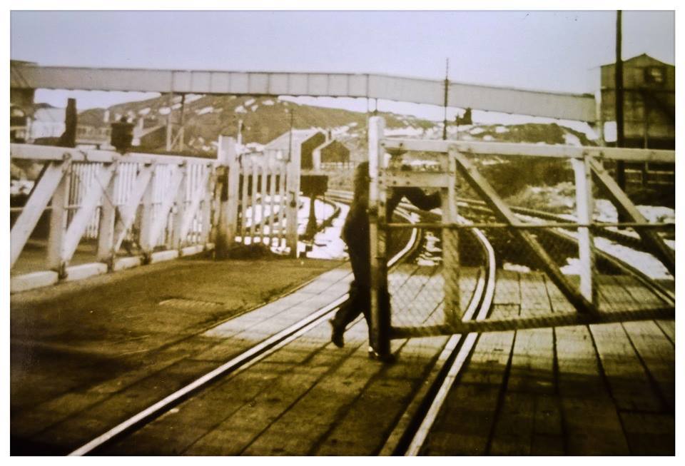
Above: Behind the crossing was West Auckland Drift pit yard and the pit heap. West Auckland Washery was to the west.
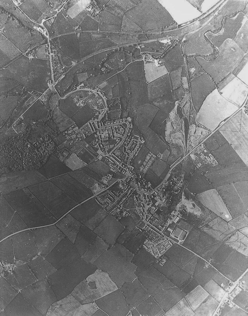
Below: c.1964 Aerial photo of West Auckland Washery with the Butterknowle Branch to the north

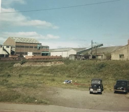
Below: West Auckland Washery from Station Road
Below: Spring Gardens Level Crossing

Below: Former Earl Grey public house next to the site of the railway level crossing

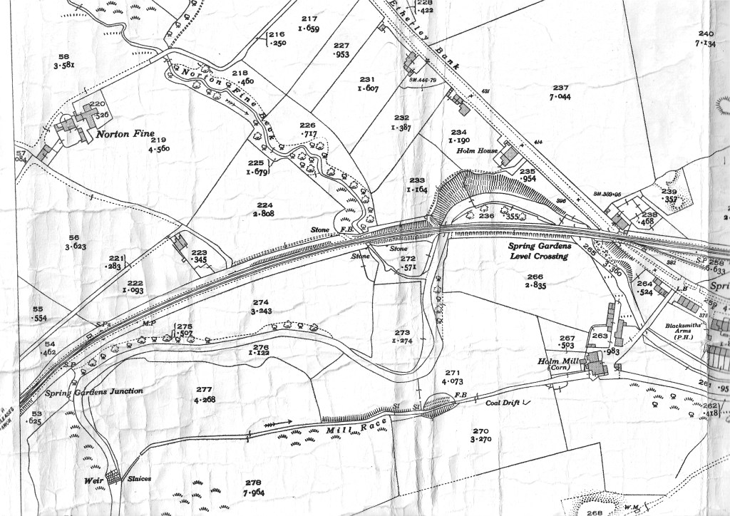
Below: Map to show Spring Gardens Level Crossing and the bridges over the River Gaunless and Norton Fine Beck
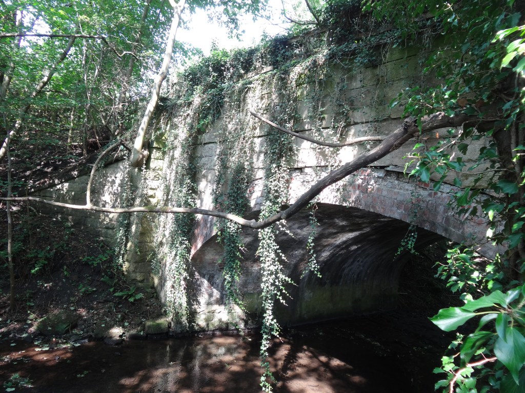
Below: First bridge over the River Gaunless, near the A68 road
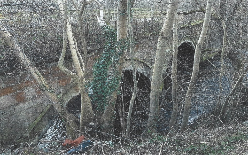
Below: Second bridge over the River Gaunless
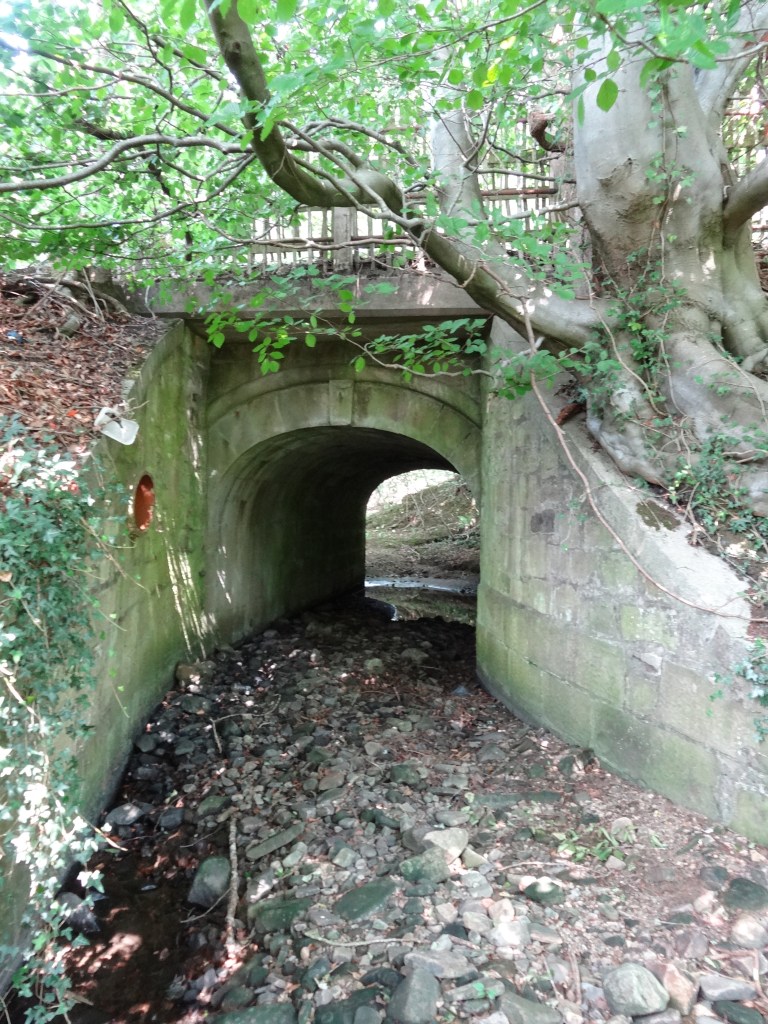
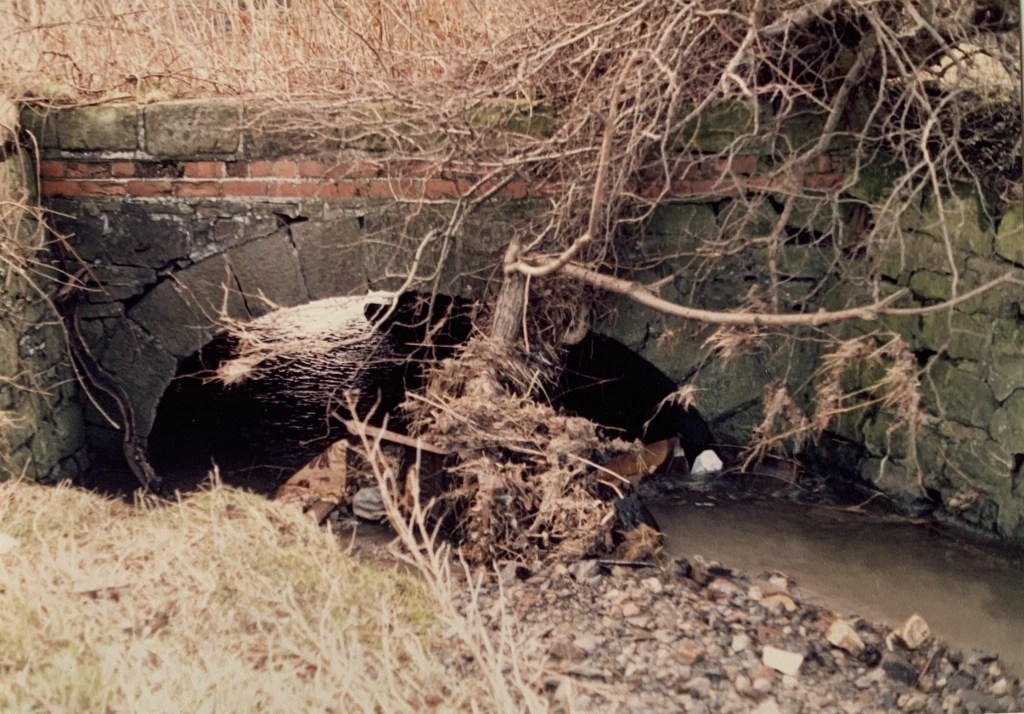
Below: Bridge over Norton Fine Beck
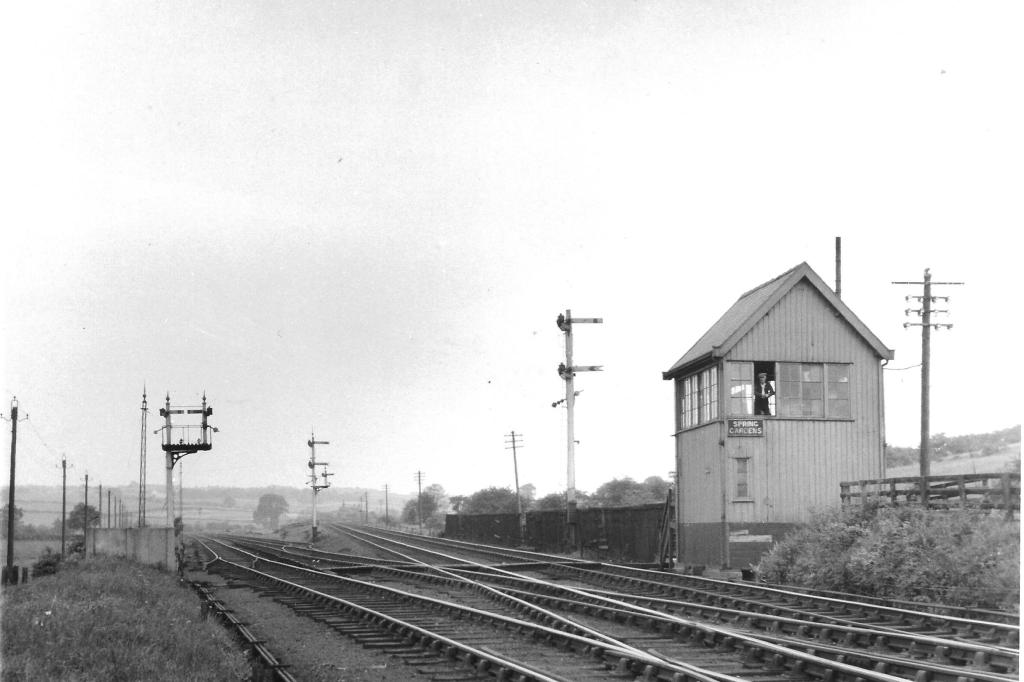
Below: Spring Gardens Junction looking westwards
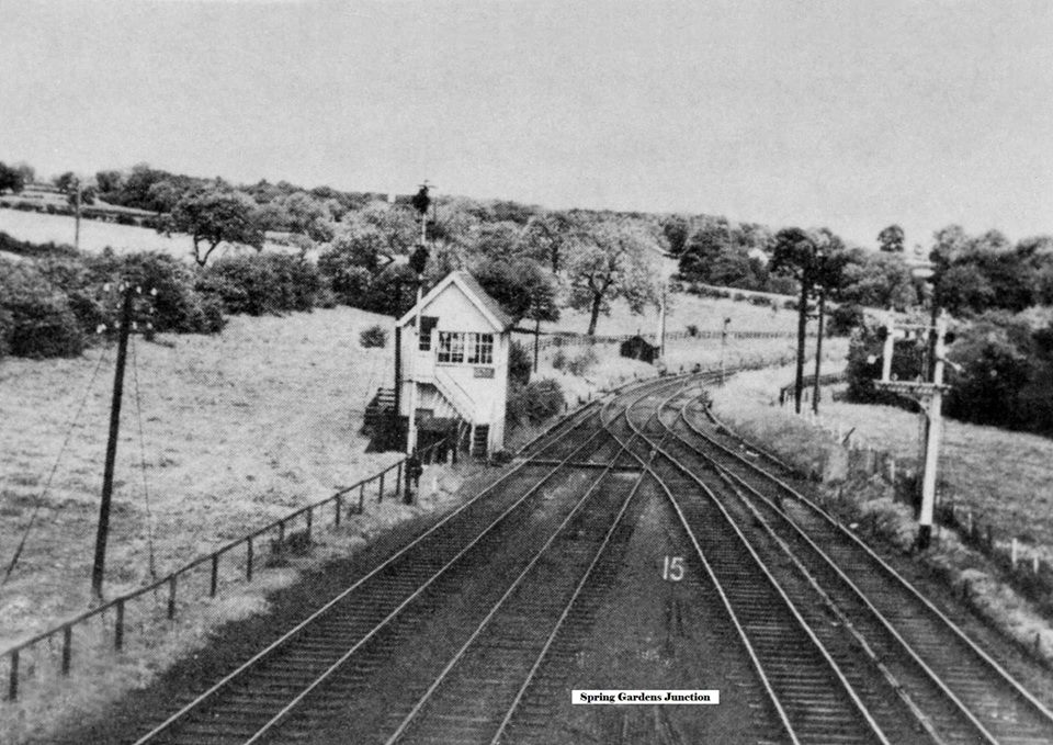
Below: Spring Gardens Junction looking eastwards
Below: c.1964 aerial photo showing the railways from Spring Gardens Junction westwards to Ramshaw
Below: A view southwards up the Randolph Incline to the pit heaps and the site of Randolph Colliery and Randolph Coke Works beyond. Note – these 2 photos were taken by Mike English before 1968.

Below: Another view
Below: 1964: Aerial photo of Haggerleazes Farm, Ramshaw showing the Butterknowle Branch and the junction to Randolph Incline. Note: The spelling uses “Z” rather then “S” as in Haggerleases Lane and Haggerleases Branch.

Below: Railway Worker’s Cottage, by the Butterknowle Branch.
This building was demolished to make way for a new house.

Below: Bridge over Gordon Gill
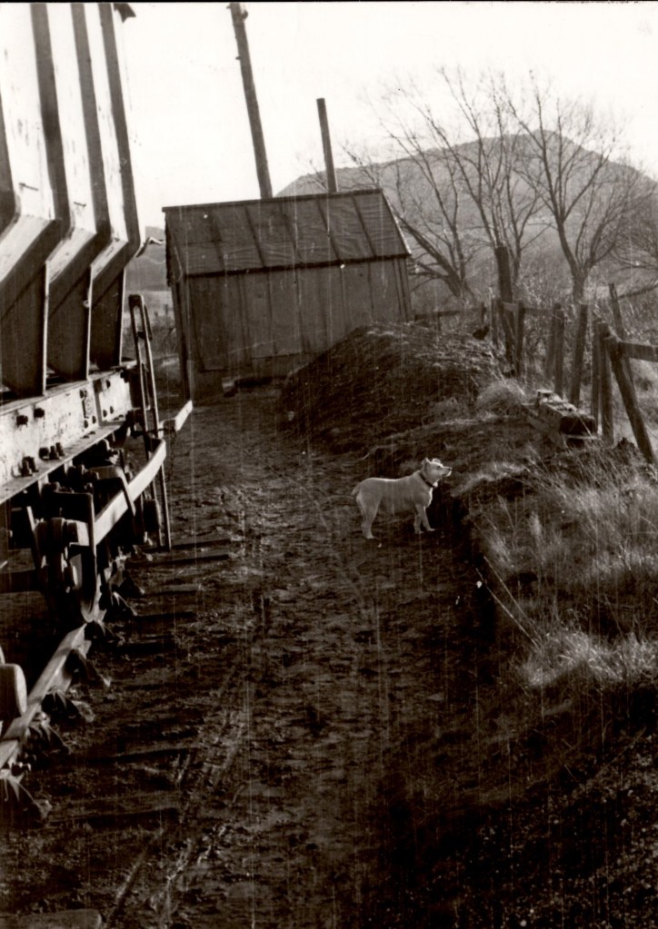
Below: East of Ramshaw level crossing. We think this is the track lifting gear about 1965.
Below: The Bridge Inn from the Butterknowle Branch

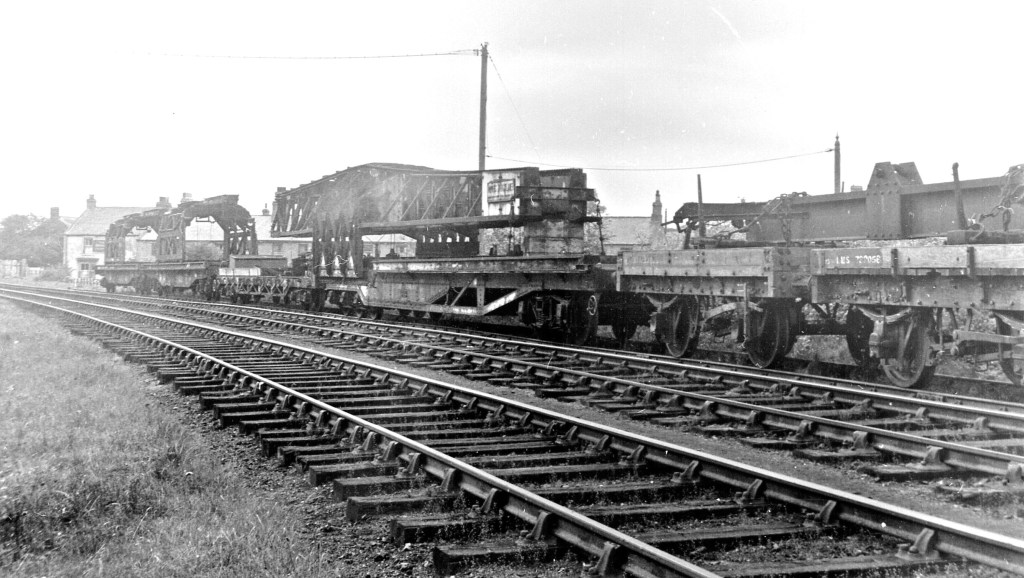
Below: The remains of the crane derrick at Evenwood Goods Depot
Below: c.1967 The Bridge Inn and the remaining track of the Butterknowle Branch. Jimmy Birch’s engineering yard occupies land formerly the Evenwood Goods Depot.
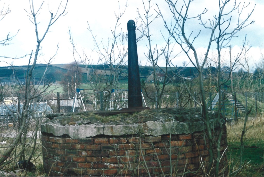
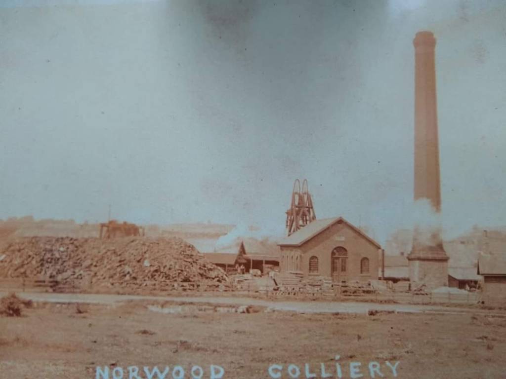
NORWOOD COLLIERY, RAMSHAW:
THE OLD NORWOOD COLLIERY WAS A COLLECTION OF DRIFT MINES LOCATED ON RAILEY FELL BETWEEN THE MODERN DAY VILLAGES OF LANDS AND RAMSHAW
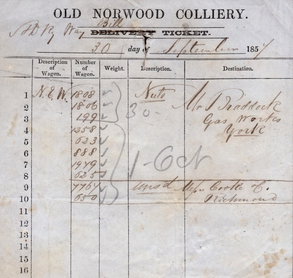
NORWOOD COLLIERY AT RAMSHAW, TO THE IMMEDIATE NORTH OF THE HAGGERLEASES BRANCH RAILWAY
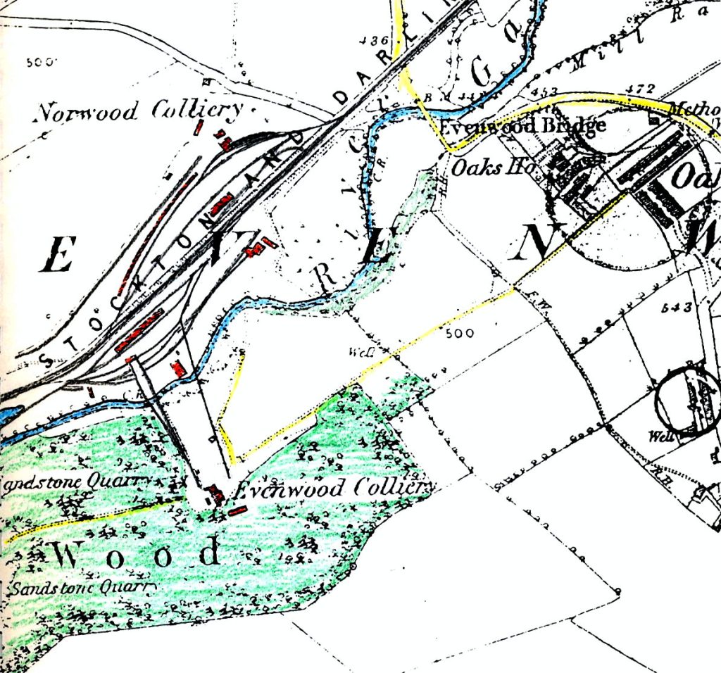

Below: A view of the tramway up to Evenwood Colliery (Southwards to Craggwood)

Below: The view northwards and down to the railway and the site of Norwood Colliery

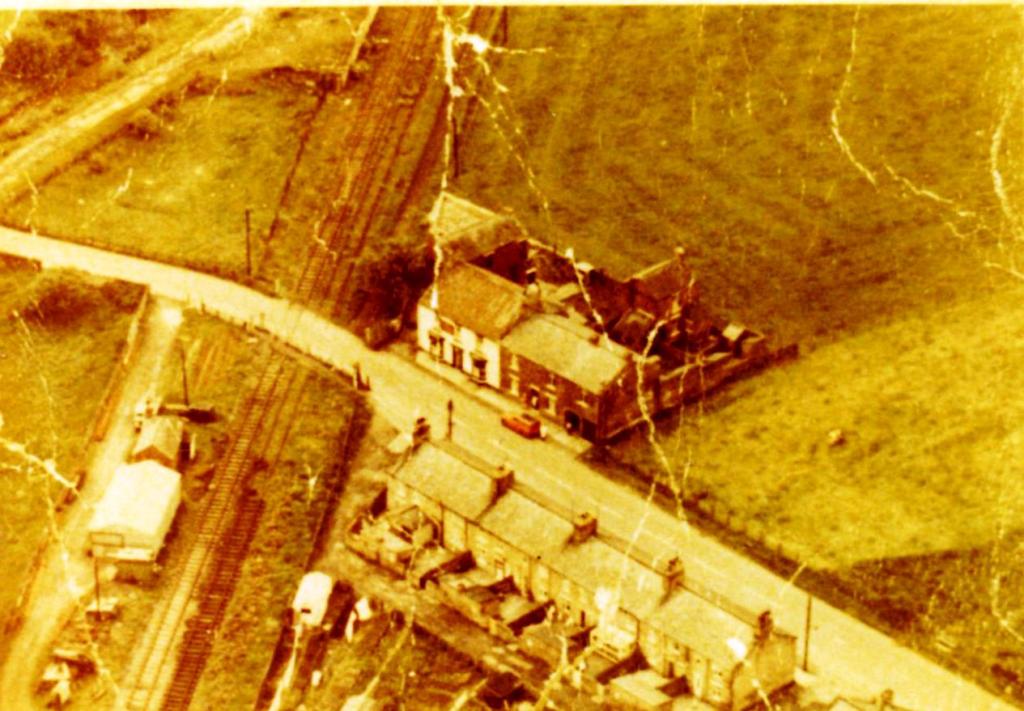
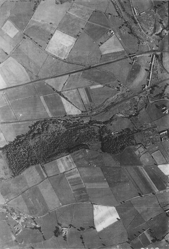
Below: c.1964: An aerial photo of land west of Ramshaw and Evenwood showing the railway lines
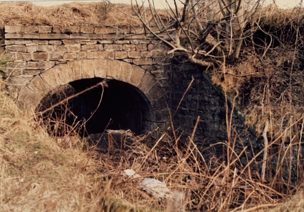
Below: c.1985: A farmer’s accommodation bridge beneath the Butterknowle Branch to the west of the site of Norwood Colliery. The bridge was constructed prior to 1830 when the Haggerleases Branch Line was opened. Fine stonework. Long since removed.
AND A FEW PHOTOS RELATING TO EVENWOOD STATION