There was not a direct road between Evenwood and Cockfield until Government projects during the depression of the late 1920’s and 30’s provided much needed work for the unemployed men of the district. This section will look at the roads which existed prior to “The New Road” from Evenwood to Cockfield.
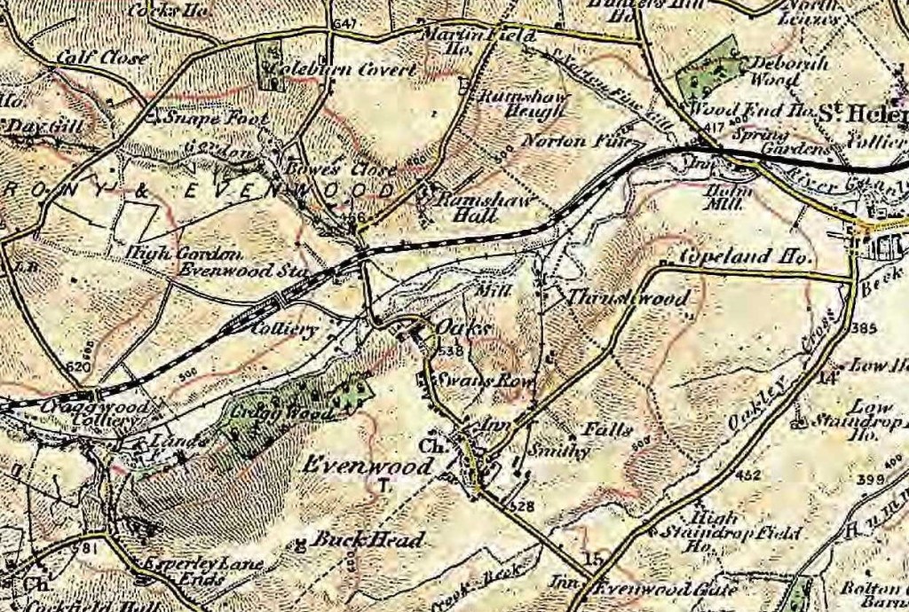
Below, this map of 1896 shows no direct road between Evenwood and Cockfield. There was a track, known as Evenwood Lane which passed by the new Norwood Colliery, over the Bishop Auckland to Barnard Castle Branch Line by a bridge and up towards High Gordon farm, then it turns 90* down to Craggwood Colliery. This road served the drift mines and pits on the Norwood Royalty, collectively then known as Old Norwood Colliery. Pack horses and carts loaded with coal would use the road and cross the River Gaunless, initially using a ford then later, Evenwood Bridge.
Evenwood bridge is a substantial structure and is similar to those over the River Wear at Witton-le-Wear and Bishop Auckland. This probably reflected the importance of the route and provided a suitable river crossing to meet the needs of cartmen transporting coal from from the Old Norwood Colliery. Lord Strathmore had a financial interest in the colliery. He may have been influential in its design and possibly contributed to the cost of its construction. Evenwood bridge is marked on the 1765 “Allotment Plan” for Railey Fell therefore it is assumed that it was built before this date. The exact date has not been traced.
The opening of the Haggerleases railway and the colliery tramway, known as the Isabella Railway, which connected the pit to the railway, meant that there was little need for this road. Presumably, the road known as Evenwood Lane fell into disrepair due to lack of use. It is assumed that only very local traffic would use this route. It is now a footpath.
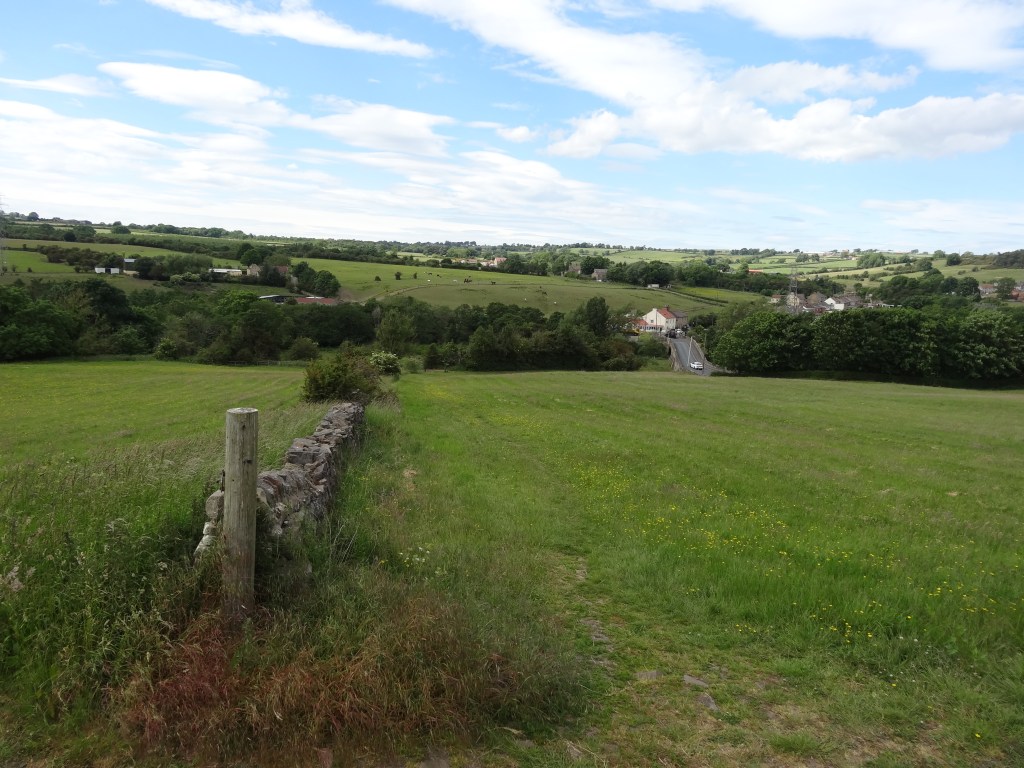
Evenwood Bridge and the road from Evenwood to Ramshaw, northwards and beyond, clearly, remained in good use. It became part of the County Council highway network.
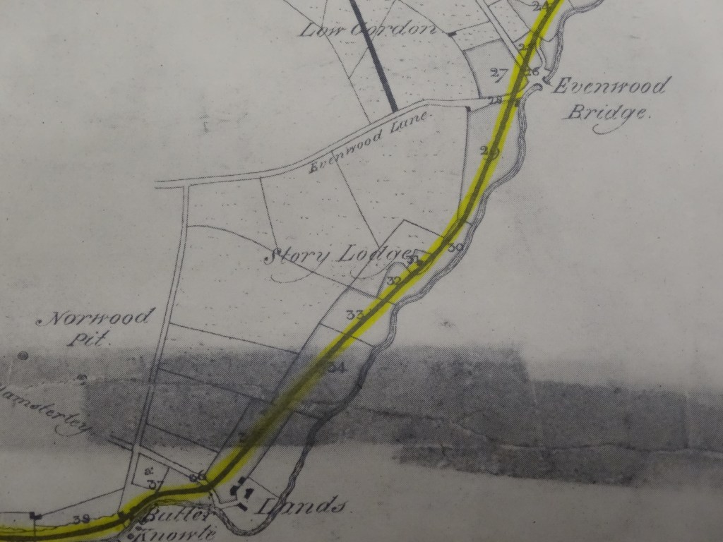
Below: 1823, Plan which shows Evenwood Lane leading to Norwood Pit
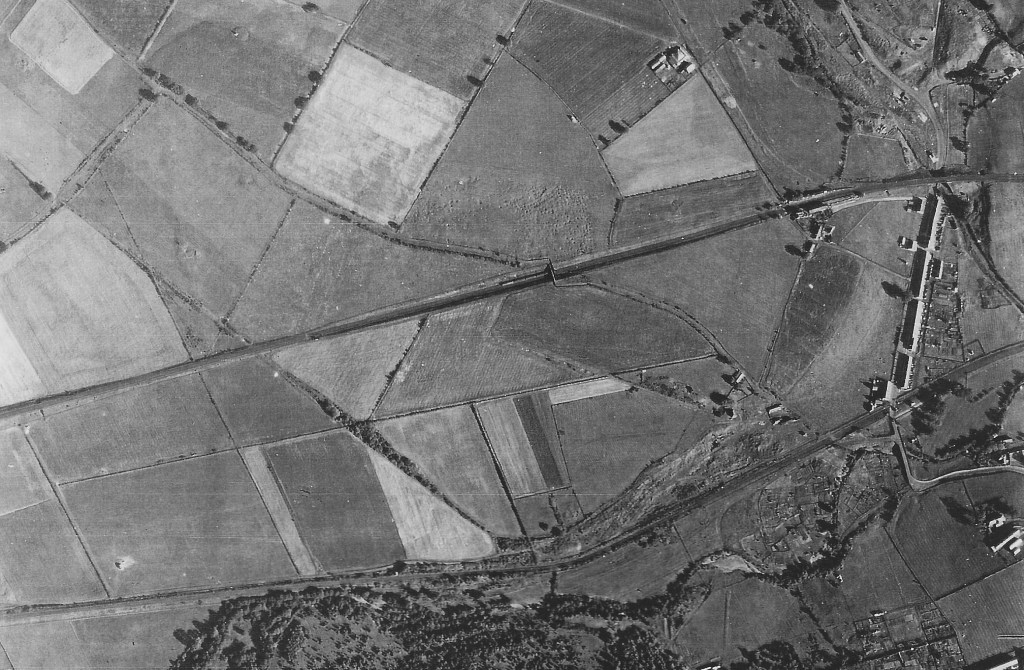
Below: probably about 1950. This aerial photo shows the area to the north of the River Gaunless. The road through Ramshaw to Evenwood Bridge and beyond, up Oaks Bank can be seen. The old road into the derelict Norwood Colliery which heads north westwards up to the “High Line” and beyond, can be clearly seen.
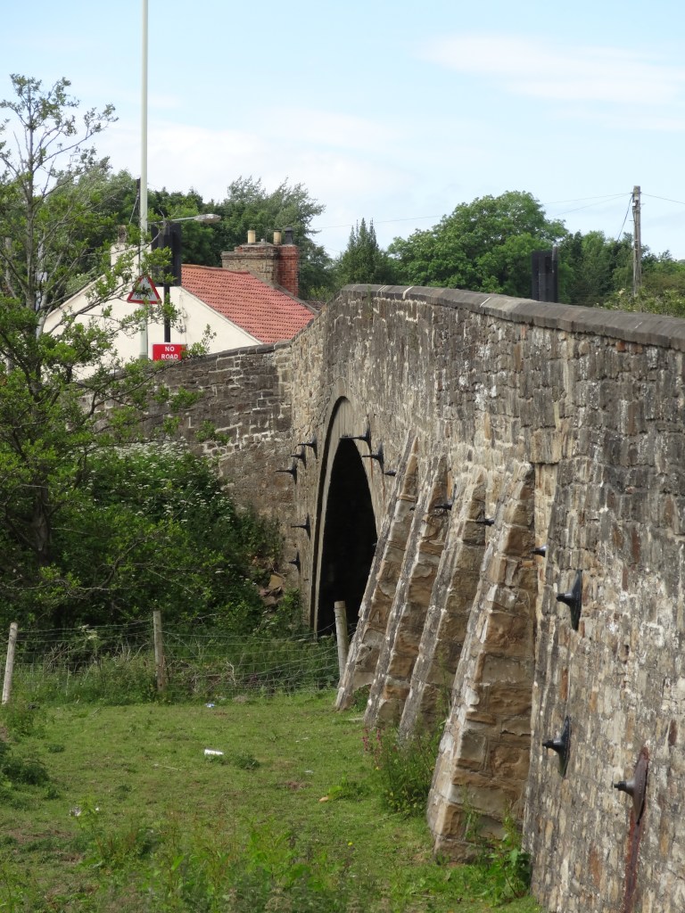
Below, Evenwood Bridge (incorrectly named Railway Crossing Bridge). This was a substantial structure required to take large numbers of pack horse and cart traffic from Norwood Colliery.

Below, Evenwood Bridge accommodating a procession., possibly 1911 Coronation of King George V and Queen Mary

Evenwood Bridge is a grade II, listed building. The description is:
“Late C.18/early19; later east half. Sandstone rubble with ashlar dressings. Wide segmental arch with recessed voussoirs supports parapet, higher over centre of arch, with chamfered coping. Small segmental flood arch on south side. Long curved wall on south east continuous with parapet along north side of road. West side has 4 triangular buttresses, later east side a battered wall, on south. NZ1499225760”
The “small segmental flood arch on south side” was associated with the mill race serving Evenwood Mill further down the river. A page will devoted to Evenwood Mill in due course.
Below: June 2021, 4 photos of Evenwood Bridge


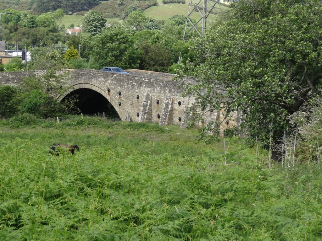
Below: June 2021. The photo shows Evenwood Bridge to the right. To the left, a line of trees above Norwood Cottage and associated buildings, heads up the hillside. This marks the route of the old road, Evenwood Lane which is clearly indicated on the plan and aerial photo (above). Evenwood Lane is now a footpath.
THE “NEW ROAD” EVENWOOD TO COCKFIELD
One road which came late to the area was the direct road from Evenwood to Cockfield. It did not exist prior to 1928. Then the existing roads from Evenwood to Cockfield would have been:
- via Evenwood Gate, the Sun Inn, Esperley Lane, Esperley Lane Ends and into Cockfield or
2. via Ramshaw, to the Toft Hill to Lands road, down to Lands and Low Lands to the junction with the Cockfield road.
The “New Road” went from the church corner, Evenwood to the Esperley to Lands road and ran into Cockfield.
Generally speaking, prior to the 1930’s, people walked a lot more than we do today. There was a footpath leading to Buckhead Farm to Esperley Lane Ends then onto Cockfield. At some point this must have crossed the quarry so was there a footbridge?
The Google map below shows the current road network of the local area.

To the best of our knowledge there is no photo which shows the New Road work gang.
The next step at Cockfield was to provide kerbs to the road side through the village and this was done in the years preceding the Second World War.
Below: A group of workmen recruited from the surrounding area to lay kerbs along the main road through Cockfield.

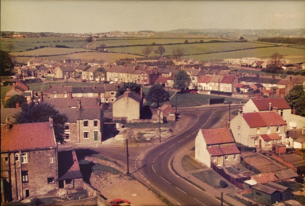
Below: Looking eastwards over Evenwood from the New Road.

Below: Almost the same view 2020
Below: The view from Randolph coke works coal bunker looking westwards over Bank Top, Evenwood and towards Cockfield. The New Road can be seen curving into the distance.
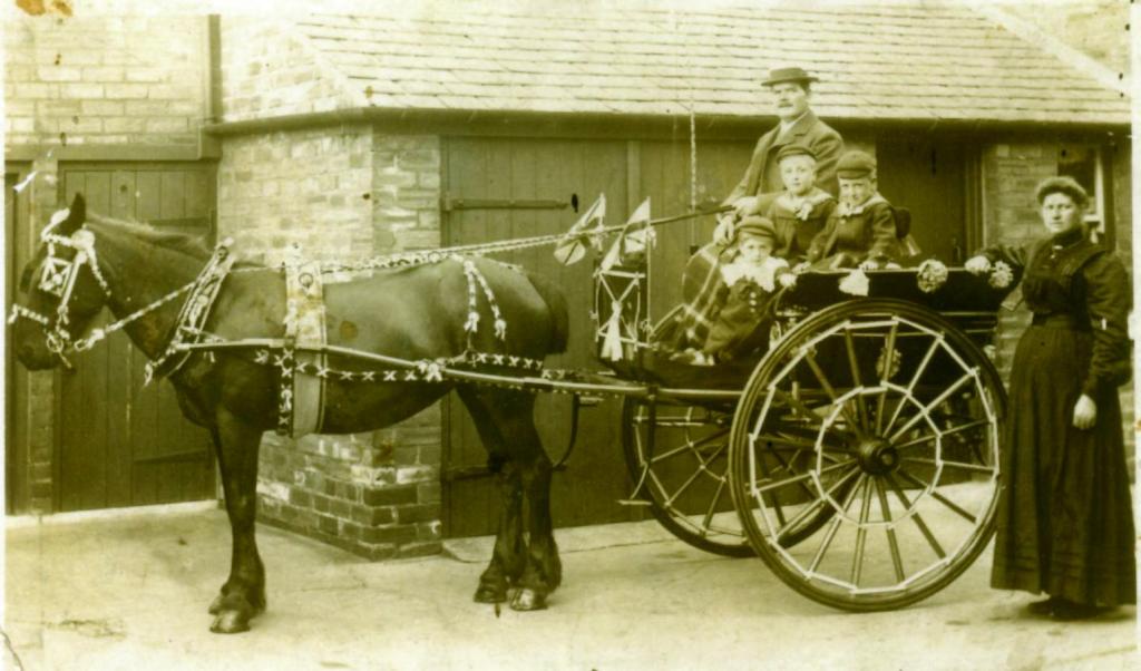
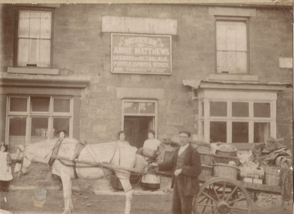
Below: 4 photos of horse transport
1911, Bob Hillary’s trap decorated for a procession – possibly the Coronation. It is similar to the one shown in the photo of Evenwood Bridge (above).
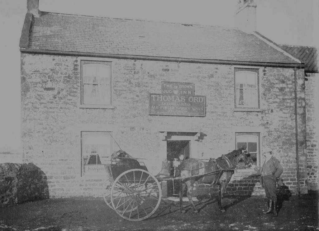
Below, about 1901, probably Thomas Ord outside his pub, The Brown Jug Inn
Below: Joe Nicholson with his horse and cart loaded with fruit & veg.
Below: 1930’s Charlie Turnbull and his ice cream carts

