The following account provides a brief description of the major events in the development of Evenwood, Evenwood Gate and Ramshaw.[1] Evenwood is a medieval settlement. Study of place names can give an indication of age of settlements. There is no mystery in the name – level wood. It is assumed that the land between Evenwood and Cockfield, now farmed by Evenfield and Buckhead farms was under tree cover and Craggwood is a remnant of the ancient woodland. As cultivation of the land took hold, tree felling occurred and fields were formed. There is evidence of “rig and furrow” farming in the fields west of the village green and at Evenwood Gate.
1017: KING CANUTE
It is a generally held belief that the area known as Evenwood was given to the church of Durham by King Canute (otherwise known as Cnut c.994 – 1035). He was King of England 1017 – 1035, Denmark from 1018 and Norway from 1028. He made many gifts to the church in the hope of buying salvation for his soul and he visited Durham as a pilgrim during the episcopacy of Eadmund. At this time the Danes became Christian and protectors of the church. Canute gave the church land and a mansion house at Staindrop, Raby and the villages of Shotton, Evenwood, Wackerfield, Aycliffe, Eldon and Ingleton.
1066: THE NORMANS
In 1066, the Normans invaded England and defeated the Saxon King Harold II at the Battle of Hastings. William I, otherwise known as the Conqueror wrought havoc to those Saxons who did not obey his rule. He placed his Norman earls into positions of power to look after his conquered lands. In 1086, his officials compiled the “Doomsday Book” which was an in depth survey of who owned what, its value and what taxes could be levied. The survey did not take in land to the north of the river Tees thus the land we now know as County Durham and Northumberland was not included. His total domination had, within a generation, almost eradicated the Saxon aristocracy and imposed a feudal society run by a small number of Normans. The name of John de Evenwood crops up in historic documents and it is assumed that he was one of Williams “henchmen” looking after our part of the world!
1183: THE BOLDON BOOK
A survey of Durham was not undertaken until 1183. Bishop Hugh Pudsey organised the work – it was called “the Boldon Buke” simply because Boldon was the first village recorded. Evenwood was not included although the village must have existed as a result of Canute’s gift to the church.
1189: KING RICHARD I
The crowning of King Richard I is taken as the date of “time immemorial”.[2]
1294: SIR JOHN HANSARD, LORD OF EVENWOOD
In 1294, Sir John Hansard, the Lord of Evenwood was involved in a number of transactions which led to the estate being taken by Bishop Bek.
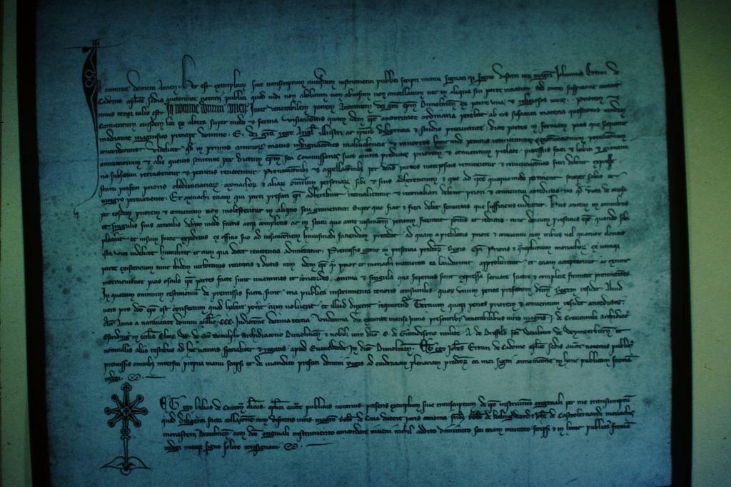
1300: THE EVENWOOD AGREEMENT
It provides evidence that there was a place called Evenwood – whether it was a small settlement around a hunting lodge for the Bishop of Durham may be open to question. Briefly, a meeting took place at the episcopal manor of Evenwood when King Edward I came to the County of Durham to mediate between Bishop Bek and the Durham monks.[3]
1331: LORD RALPH DE NEVILLE
In 1331, Bishop Beaumont granted the Manor of Evenwood to Lord Ralph de Neville.
1377 – 1382: THE HATFIELD SURVEY
Bishop Hatfield’s survey records that several people held lands at Evenwood:
- Lord Neville held Colt Park (of the inheritance of John de Evenwood)
- John de Sadberg
- Hugh Willison held lands and tenements
- Thomas Hansard held the Barony tofts and 18 July 1368 there was a lease for a bloomery (an iron furnace) in Gordon and Evenwood Park, the wood to be provided by Allan, a fellow in the service of the Bishop.
- Bishop Hatfield and Fordham were appointed Park Keepers at Evenwood
- Walter de Hallyk had coal works within Deanfield and Morley, in the Barony of Evenwood.[4]
Coal mining leases have been granted by the Bishop of Durham in the immediate area since the 1300’s therefore there must have been settlements built around any such coal mine to house those who worked there.
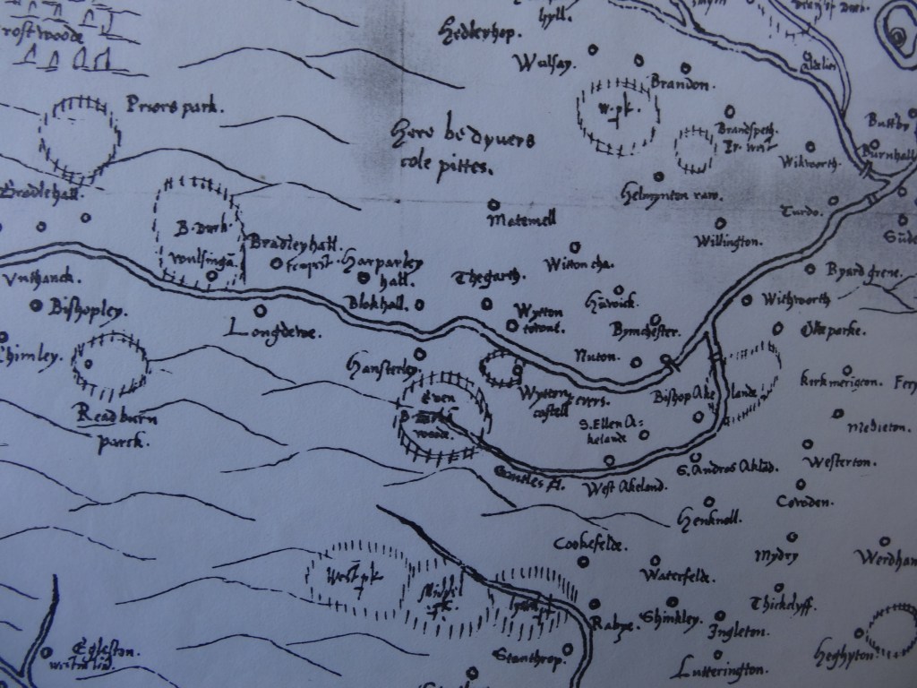
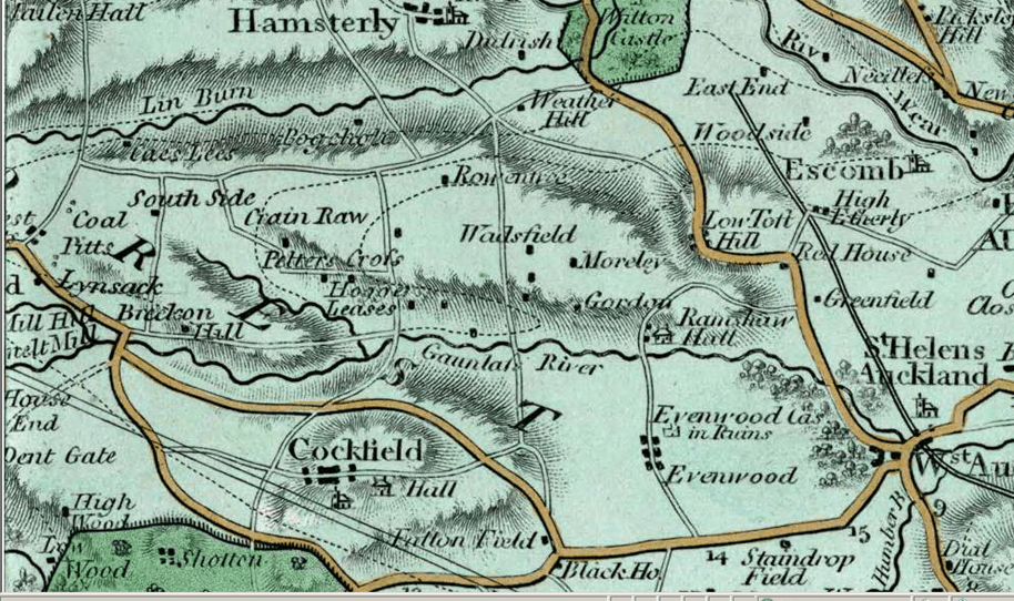
1569 CECIL’S MAP
William Cecil Lord Burghley, Elizabeth I’s Secretary of State. Burghley used this atlas to illustrate domestic matters. This map is contemporary with the uprising of the northern peers in defence of Mary Queen of Scots. It dates from 1569.
Evenwood is indicated and what appears to be a park enclosure north and south of the river Gaunless.
PRE 1603
The 14th, 15th and 16th centuries were largely periods of misery and want in Durham, and steady depopulation due to the ravages of the Scots and outbreaks of plague resulted in neglected fields and devastated villages. Only after 1603 when England and Scotland were united did stable conditions prevail in Durham. [5]
1611 SPEED
Another map which shows “Evenwood Park.”
1646 PARLIAMENTARY SURVEY
By 1646, another survey refers to:
- “a goodly house, called the Barony but the same was then utterly decayed and had so been for many years
- “A Park containing 300 acres
- “That within the manor or barony lie the townships of Killerby, Evenwood and West Auckland
- “That there is belonging to the aforesaid barony a great common or waste called Railey Fell on which the cattle are put without stint.
- “But there is no wood on the same nor any in the barony [6]
- “There is a great colliery within the manor called Thorne in lease from the bishop… and let to Mr. Drake… who has assigned it to Mr. Charles Vane and Mr. Thomas Bowes.”[7]
1750 KITCHEN’S COUNTY MAP
Evenwood is indicated.
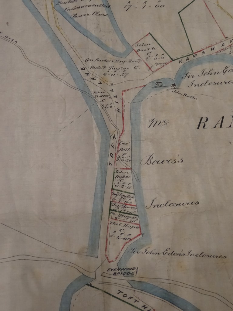
1765: ALLOTMENT MAP [8]
The map, produced by Richard Richardson of Darlington in 1765 was described as:
“A plan of the division of a certain Moor or Common known by the name of Railey Fell within the Manor of Evenwood and Chapelry of St. Helen’s Auckland and County Durham, shewing the Allotments belonging to the Townships of Evenwood and West Auckland.”
The plan relates to land largely to the north of the River Gaunless and Evenwood bridge. It includes an approximately triangular shape of land to the south, known locally as Oaks Bank and the Oaks. Most parcels of land have a name attached to them.


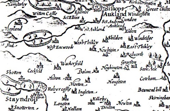
1768 ARMSTRONG’S COUNTY MAP
Evenwood is indicated together with the notation, “Evenwood Castle in ruins”. There is a small illustration which gives the impression of a substantial building. This is the first evidence we have found to date which indicates “Evenwood Castle”
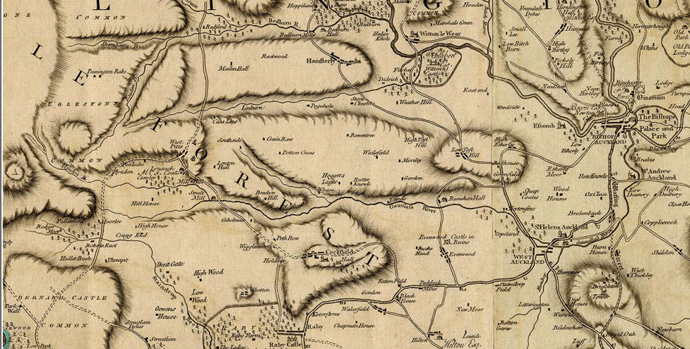
1777 BOWEN’S COUNTY MAP
Evenwood and Ramshaw Hall are indicated.
1790: STRATHMORE ESTATES PARKINS’ PLAN [9]
A plan of the Earl of Strathmore’s Estates in the township of Evenwood in County Durham was surveyed by Parkins. It shows an area of land to the north west of Evenwood and includes the following notation:
“These estates are bounded on the north [and on the west side of High Pasture No.11] by a part of Lands Farm belonging to the Earl of Strathmore who holds the same as lessee by lease of three lives under the Lord Bishop of Durham. The said Estates are clear of tythe of all kinds in lieu of which a Prescript or Modus of £7 4s is paid annually to the Curate of St. Helen Auckland.”
There are 17 named fields and acreages in a schedule, for instance 1 is South Field, 11 is High Field, 15 is Stones End Field and 16 is named “Garth”. Several notes are included on the plan for Field 16:
- The Mote
- Stack Yard, Barn and Fold
- Foundations of Evenwood Castle
Surrounding land owners are Mr. Hutton, A. Hutton, Sir Ralph Milbank and George Emmerson.
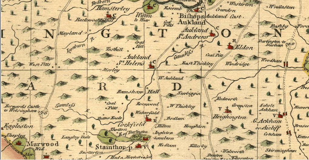
1816 COLE’S COUNTY MAP
Evenwood Castle is noted.
1818 LANGLEY’S COUNTY MAP
Evenwood Castle is noted.

1820 GREENWOOD’S COUNTY MAP
This map shows Evenwood is illustrative form with undeveloped land in a central location giving the impression of a village green.

1826 EBDEN’S COUNTY MAP
This map shows Evenwood and the notation, “Rs of Evenwood Cas” taken to be, the ruins of Evenwood Castle.

Pre 1830 PLAN STRATHMORE PAPERS [10]
An undated plan titled, “Plan of part of the ancient enclosed lands in the Barony and Township of Evenwood in the Parish of St. Andrews Auckland Durham” illustrates in detail, land holdings. The central area of Evenwood is clearly shown with little or no development and can be identified as the village green. A pinfold is located in a central position. The farm land to the west of the green owned by Mr. William Bainbridge.
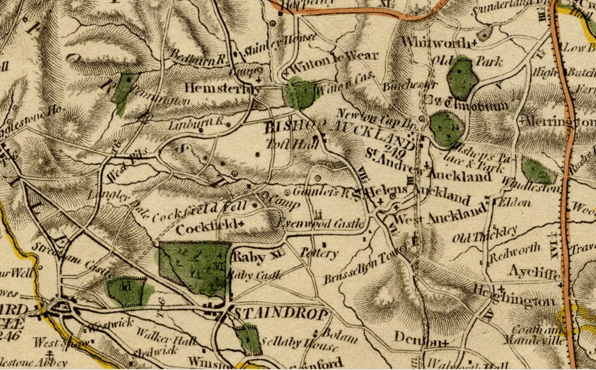
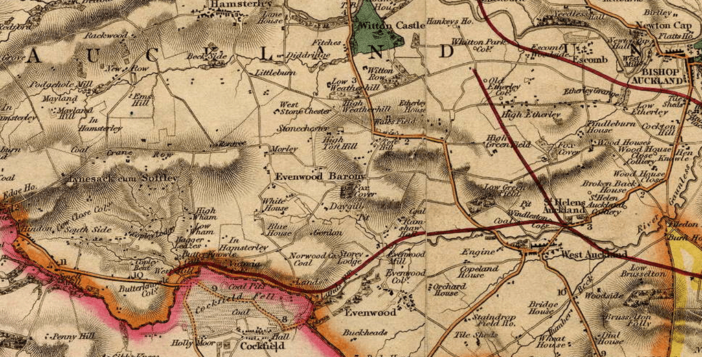
1830 ROWE’S COUNTY MAP
This map shows Evenwood and the notation, “Ruins of Evenwood Castle”. The route of the Haggerleases Branch Railway is shown.

1831 CAREY’S COUNTY MAP
This map shows Evenwood and the notation, “Evenwood Castle in Ruins”. The route of the Haggerleases Branch Railway is not shown.
1831 MURRAY’S COUNTY MAP
This map shows Evenwood and the notation, “Ruins of Evenwood Cas.” The route of the Haggerleases Branch Railway is not shown.

1832 GREENWOOD’S COUNTY MAP
This map shows Evenwood. The route of the Haggerleases Branch Railway is shown.
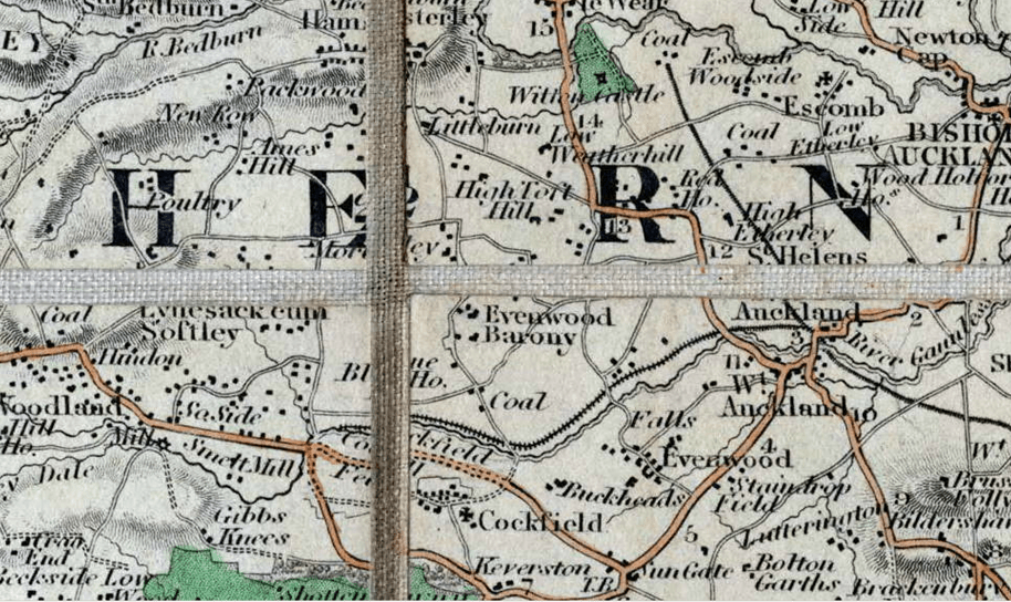
1840 HOBSON’S COUNTY MAP
This map shows Evenwood is illustrative form with undeveloped land in a central location giving the impression of a village green. It shows Evenwood Colliery, Evenwood Mill, Ramshaw Hall and other properties of note.
1842 CREIGHTON’S COUNTY MAP
This map shows Evenwood.

1842 TITHE MAP [11]
This map is to 1:1250 scale and illustrates the built up area of Evenwood and surrounding district. The central area, built form and village green are clearly shown. To scale, this map effectively puts detail on the pre-1830 [undated Strathmore map].

1857: FORDYCE’S HISTORY
William Fordyce’s history provides further details:
“The united constabularies of Evenwood and Barony form a township on the south west of West Auckland, containing 5,336 acres……The constabulary of Barony being on the north side of the Gaunless, is connected with that of Evenwood by a bridge.”
It was reported that the Bishop Durham owned that land under copyhold and received rent at 4d per acre. John Bowes MP was the freehold owner of land at the south western extremity. An extensive portion of the township to the north called Reiley Fell was divided into allotments by an Act of 1759 – the royalty belonged to the Bishop.
1859 ORDNANCE SURVEY MAP 1st EDITION
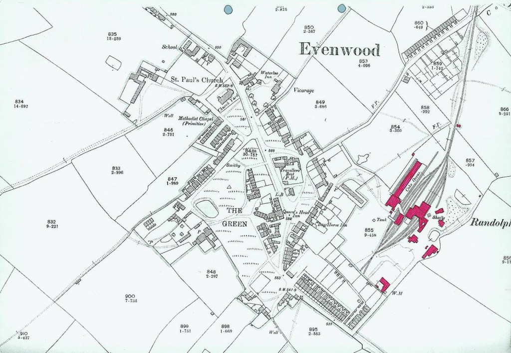
The map was surveyed in 1857, contoured, engraved and published in 1859 at the Ordnance Survey Office, Southampton to a scale of 6” to the statute mile. A series of map at the scale of 1:1250 and 1:2500 was later published. The maps show well established topographical features including spot heights above sea level and development. The built up areas of Evenwood and Ramshaw are illustrated and the open space in the centre of Evenwood is clearly recorded as The Green with a number of access tracks crossing it and a pond located to the west near Kays Hall Farm. At this time, there was no parish church.
1873 NEWCASTLE WEEKLY CHRONICLE [12]
The earliest account that has been traced reports:
“The village is one of those many concentrated assemblages of cottages which always look interesting and picturesque. There are few straight lines about them. The rows run at all angles and many of them no particular angle…This higgledy-piggledy style of village arrangement has undoubted advantages of high value. It gives a great deal of free space and unlimited playground for youngsters.”
The writer was impressed with the village green, described as follows:
“…it has for many generations served as a recreation ground for youth and a lounging place for age. It is decidedly one of the nicest bits of free ground to be visited. It contributes largely to the health and happiness of the entire community. Let no ma, lay brick or paling there upon as long as the ages last.”
1874 STRATHMORE PAPERS [13]
The plan accompanies legal papers dated 9 May 1874 between Lady Glamis widow of John Bowes Earl of Strathmore, the Right Hon. Claude Bowes Earl of Strathmore, Sir William Hull of Gibside and the Bishop of Durham which concerns the rights to open coal pits. The plan illustrates the village of Evenwood and Bowes Freehold lands. The green is indicated in outline.
UNDATED PLAN: STRATHMORE PAPERS [14]
This plan is titled, “Plan of Evenwood and Norwood Estates”. The village of Evenwood is illustrated in an unclear style but similar format to the previous Strathmore 1874 map. Regardless of its limitations, the green is discernible. The purpose of the plan appears to locate the position of a proposed new pit on land to the west of the green therefore the precise boundaries of the green would be irrelevant in this instance.
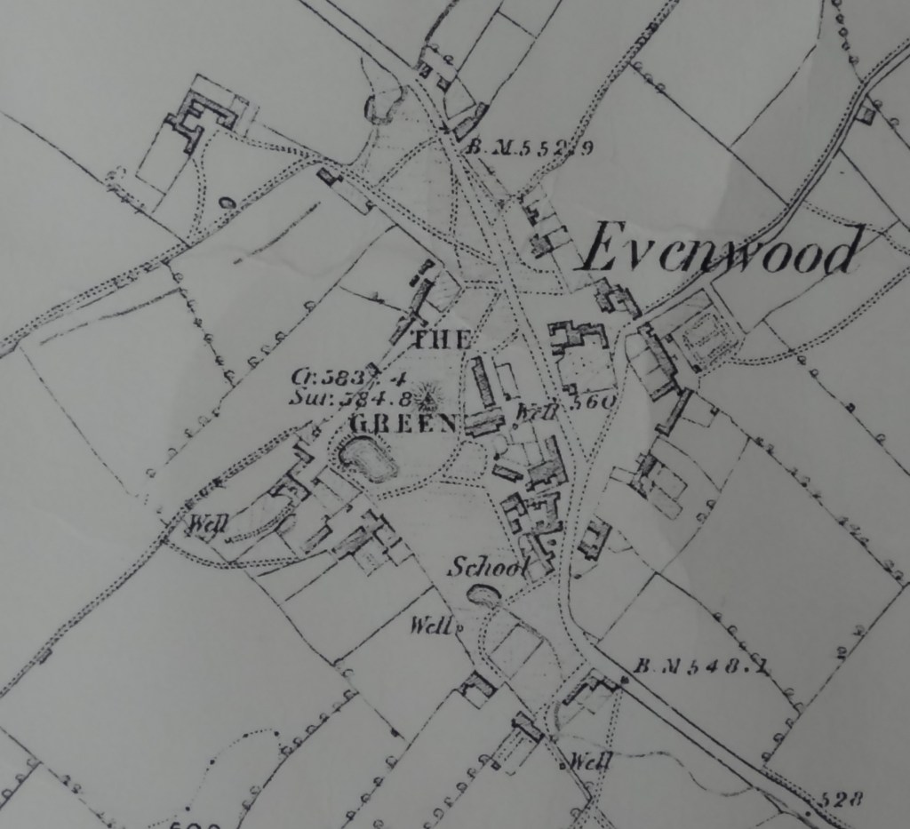
1898 ORDNANCE SURVEY MAP 2nd EDITION
Additions are clearly shown, notably the school, St. Paul’s Church, Randolph Colliery and housing. The new Anglican church occupies land to the north of the village green. A smithy was located in South View, the terrace of houses to the north of the Green. There was a pond.
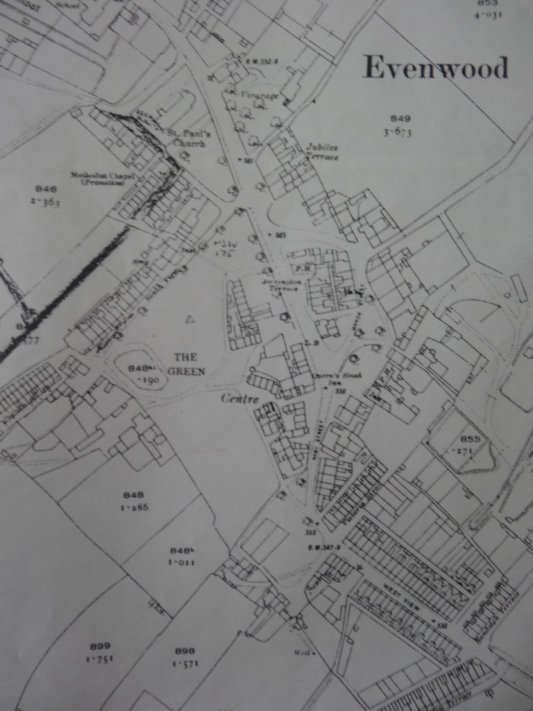
1924 ORDNANCE SURVEY MAP 3rd EDITION
Surveyed 1856-58, levelling revised in 1896, surveying revised in 1914-19 and printed and published by the Director General of the Ordnance Survey Office, Southampton. Additions are clearly shown, notably the addition of 2 terraces of houses called Accrington Terrace and Manor Street which are located within the boundaries to the south and south east of the Travellers Rest public house. Other development took place at locations along the extremities of the village. The pond is still in use.
A SUMMARY OF DEVELOPMENT [15]
Evenwood village green is ancient. It is protected. It is likely that a manor house or some other fine building was erected on the site of Church Farm. Early maps indicate that there was a park and a “castle” in the vicinity. Some maps are noted with, “Castle in ruins.” There is evidence of what looks like a moat. The village was built around the green and houses were built along the roads such as Stones End. Evenwood Mill was established from an early date (see notes elsewhere). Ramshaw Hall was in existence from the mid-1600’s. It is a listed building and protected (see notes elsewhere).
Two hundred years later, when coal mining commenced commercially at Norwood and the railway entered the Gaunless Valley in 1830, houses were built at Gordon Lane and the Oaks. Other houses were built by coal companies at Copeland Row (initially called Tees Hetton Row) and Chapel Street. Another colliery terrace was called Charlotte Row but where was it? More terraces were built at Gordon Lane including a small terrace behind. When was Ramshaw adopted as a name for this settlement? Ramshaw Hall and Ramshaw Farm are some way to the east. It must have been before 1910, when Ramshaw School was named.
Randolph Terrace was built at the entrance to Randolph Colliery in the 1890’s. Other terraces were built around the Green such as South View, the Centre, Manor, Raby, Jubilee, Accrington and Alpine leading westwards from the Green. More terraces along the main roads such as West View, Farncombe, Shirley and Swan Street were built as Randolph Colliery developed and its workforce increased. Building at Alexandra Terrace was presumably commenced about the time of the Royal visit to Randolph Colliery in 1900 and named in her honour. Probably just after 1904, terraces behind the Co-op, Rochdale and Provident then later about 1910, Delaware Avenue (from Rochdale, Lancashire to Delaware, USA!). The Poplars, Osborne and Maude Terraces probably followed.
Evenwood Gate was developed with a long terrace opposite the Brown Jug pub. Originally, there was a turnpike gate and a toll house associated with the Bowes to Sunderland Bridge toll road. The pub would have been established to provide ale and food for cart men. The small terrace leading down to the pottery was called Clyde Terrace. There was a small terrace of houses at the pottery (4 in total?) which was called New Moors Pottery.
There was little or no building after World War 1 (1918) due to the difficult economic circumstances which prevailed in the North East of England, particularly south west Durham. Many people left the area and it suffered a significant reduction in population. Council houses were built after the Second World War (1945) as and when money was made available to local councils and housing associations. There has been no private housing in Evenwood Gate and Ramshaw, mainly as a result of prevailing “planning policies” which restricted development until the relatively recent redevelopment scheme on the site of the Brown Jug. In post war years, there have been 2 private schemes in Evenwood at Neville Close and Lynas Place and several individual dwellings constructed.
SOME DATES
1830 May: West Auckland to Evenwood, a section of the Haggerleases Branch Line opened.
1830 October: Haggerleases Branch Line fully opened to Haggerleases Lane, east of Butterknowle.
About 1840: The Oaks was built.
1860: Primitive Methodist Chapel – likely to be the chapel which was opposite the church, hence Chapel Street.
1863 August 1: South Durham & Lancashire Union Railway opened. It ran from Bishop Auckland to Barnard Castle, over Stainmore, to Tebay and onwards to Barrow-on-Furness.
1865: The National School was opened, (now the Randolph Community Centre).
1865: Ramshaw Colliery School built by Stobart & Co. It later became the Railey Fell Colliery Miners’ Institute before being demolished.
1865: St. Paul’s Church foundations laid.
1866: St. Paul’s Church opened.
1868: The Vicarage built, now a private dwelling.
1868: Brookside Cottage – W.E. inscribed into a lintol over the front door, Wade Emmerson
1870: Ramshaw Primitive Methodist Chapel.
1876: Wesleyan Chapel, Swan Street.
1884: Evenwood Station Master’s House and offices opened.
1885: Jacob Wright Almshouses.
1890/91: St. Paul’s Church restored.
1892: Evenwood National School – foundations for Infants Room.
1893: Infants Room opened.
1897: Randolph Institute, South View opened. Currently a private dwelling and an undertakers’ premises.
1897: Victoria House, Victoria Street.
1904: Evenwood Co-op opened.
1906: Congregational Chapel, Swan Street – this building has been demolished.
1907 December 29: St. Paul’s Church fire
1909: St. Paul’s Church reopened.
1910: Ramshaw County School opened.
1912: Primitive Methodist Chapel, Shirley Terrace, now the Parish Hall.
1925 January 24: Aged Miners’ Homes opened, now Devonshire Place.
1950/60: Newholme Crescent, Wellgarth and Shirley Close local authority housing built.
1951 September: Evenwood School Central Kitchen opened.
1957 June 19: The Oaks Clearance Order became operative.
1957 October 14: Evenwood Station closed to all traffic.
1960: Randolph Colliery closed.
1962: Randolph Hutton Drift closed.
1962 June 18: Barnard Castle East to Spring Gardens Junction closed.
1963 September 30: Evenwood to Butterknowle Goods Yard closed.
1968 August: Randolph sidings, Evenwood to Tunnel Junction closed.
1968: Evenwood Engineering established.
1974: Evenwood (Church of England Controlled) Primary School opened.
1974: Fairfield local authority housing built.
1983: C.A. Roofing established.
1984 May 25: Randolph Coke Works closed.
1984: Evenwood Co-op closed.
1984 December: Randolph chimney and coal bunker demolished.
1987 March: Reclamation of the Randolph site and pit heap commenced.
1987 April: The Manor House was demolished.
About 1989-92: British Coal Opencast Executive worked the Thrushwood site which removed the Randolph pit heaps north of Copeland Road.
About 1989-91: Neville Close built by R.L. Wade (St. Helens).
About 1992-93: Manor Court, Manor Street by Durham Aged Miners’ Association.
2005: Spring Gardens dam and wetlands formed as part of the flood prevention scheme for West Auckland and South Church.
2009: Lynas Place built by Bett Homes.
2019: Evenwood Gate, housing on the site of the Brown Jug commenced.
1964 NAIRN’S CUNTY DURHAM [16]
Of Evenwood, it was written:
“The next village to Cockfield and the same recipe – industry superimposed on the village green – but a completely different result. Where Cockfield is robustly simple, Evenwood is one of the most subtle and complicated villages in the county and the industry has augmented this character rather than spoiling it. Basically, a square village green. The road runs off the centre near the eastern side and houses have grown up around it, called simply, “The Centre”. These are a wonderful huddle of shapes and sizes, still in good condition and must be kept. So many of them, in fact, that village street has been superimposed on the village green. The part behind to the west feels like a remote backwater, an extension of the working farm which takes up most of the west side. The part to the east is all intricate corners, squashed up under the silhouette of the pit gear a field away. County Durham in a nutshell. And this tension is carried down to the smallest thing, which makes a walk around Evenwood really exciting. A violent row rightly called Accrington Terrace, amongst the cottages, staid Victorian stockbrick broken by the big gable of a doctor’s surgery. Tiny pantiled cottages everywhere, miraculously used as storehouses or extra rooms instead of being demolished. Although it is in good condition, this is such an unlikely place in which to find one of the best villages in Durham that it needs an especial watch kept on it.”
1974 ORDNANCE SURVEY MAP 4th EDITION [17]
This edition was the metric version of OS maps with heights given in metres above the Newlyn Datum, levelled in 1965 to 1:2500 scale, photographically reduced to 1:1250. Further additions are clearly shown, notably post war housing and industrial development. There were no significant alterations to the shape of the village green. The pond had been filled in. A public convenience was built [since demolished]. A bungalow was built at the junction of the main north to south road and the spur leading to Copeland Road [north eastwards then eastwards to West Auckland].

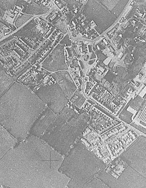
c.1974 AERIAL PHOTOGRAPH OF EVENWOOD
The limits of the village green are clearly shown.
c.1983 AERIAL PHOTOGRAPH OF BUCKHEAD OPENCAST SITE
A detail from the photograph clearly shows the village green in relation to Kays Hall Farm, the fields to the west and the rest of the village.

A REVIEW OF STUDIES INTO VILLAGE GREENS WITH PARTICULAR REFERENCE TO EVENWOOD
1949 THORPE [18]
“Twixt Tyne and Tees” are located no less than 101 green villages.[19] Evenwood belongs to the 3rd category, “indefinite shape only partly enclosed by houses”.[20] Of the 101 green settlements, all except 11 are mentioned in previous historical records as being in existence before 1200AD, we have no evidence as to whether they did or did not possess a green. [21] Evidence for the existence of settlements before the Norman Conquest.[22] Evenwood is included as a settlement with late Christian associations [867 – 1066AD].[23] Thorpe concludes:
“…it appears that the green villages of Durham have developed from original defence enclosures largely on naturally open sites, often small in extent, in formerly forested country. Although we know that many of the sites of these villages were occupied in early Anglian times, we cannot be certain that these primary settlements had a central green…on the other hand, in England as late as the eighteen century…squatting settlements with a rather shapeless green and a loose arrangement of houses were appearing in many areas of deforestation ” [24]
His final sentence is:
“Much evidence of our rural settlement forms has already been destroyed and many existing green villages, such as Shadforth in Durham, are beginning to decay or have been swamped by urbanisation. It is important to record the old character of our villages before it is too late.”[25]
It could be argued that the conservation movement has sought to preserve ancient village greens and has enjoyed a certain amount of success.
1992 DURHAM COUNTY LOCAL HISTORY SOCIETY [26]
Evenwood village green is described as follows:
“Evenwood, a rather loose clustering of farmsteads around a rather irregular green, may reflect the plan of an ancestral type of hamlet, rather small and unformalised.”
1994 SHIRLEY [27]
The thesis contains several specific references to Evenwood village green, particularly the attitude of the owners.
Manorial Courts – The surviving presentiments of court meetings at Auckland, Easington, Houghton and Evenwood showed 15 cases between 1684 and 1832. Of these there were 8 for inclosure and encroachment, 3 for depositing manure, 2 for removing soil, 1 for illegal pasturing and 1 joint offence. [28]
Encroachment onto village greens was a widespread practice. Tithe maps of 1838 show the state of encroachment in several Durham villages including Evenwood where there were 10 gardens on the green. The only way for encroachment to lawfully continue is by private Act of parliament. [29]
Leasing of village greens – The Ecclesiastical Commissioners considered it desirable that the Parish Councils have control of the green to prevent encroachments. In 1914, Durham Bishopric estates stated that they had at various times [including 1895 and 1902] and following the advice of the Ecclesiastical Commissioners, offered to grant a lease to the Parish Council but it had never been accepted. The offer was renewed, subject to the commoners’ approval and reserving mineral rights. Some met with local opposition. This may have been the case at Evenwood since the green is still under the control of the Church Commissioners. [30] Shirley stated:
“In County Durham, for example, many of the greens are very large, having survived over the years in the highly conservative environment of the estates of the Bishop and the Dean and Chapter, the greens themselves remaining such important and well known foci of the nucleated settlement and their inhabitants, they could not easily escape registration.” [31]
“While the whole of this area (Durham, Northumberland and the North Riding) was once thick with villages (and hence village greens), Durham settlements have been largely preserved whereas those to the west and south have not remained to the same extent… County Durham, where many of these greens still remain, was largely owned by the estates of the Bishop of Durham and the Dean and Chapter until the early 19th century. These lords exerted a strong influence of ecclesiastical conservatism over the area and as a consequence it became a very backward area with a great resistance to change and many of its greens still remain today whereas in the surrounding areas they have been inclosed.” [32]
It is the opinion of Shirley that the conservative attitude of the ecclesiastical authorities is largely responsible for the past protection of the village greens in County Durham.
2006 COMMONS ACT
Evenwood Village Green was registered by Durham County Council, reference VG33.
2016 OPEN SPACES SOCIETY [33]
Graham Bathe comments:
“Differing attitudes towards change have also helped protect greens. While the whole north east once held large numbers of village greens [as revealed by “green” place names], most have been lost to enclosure and agricultural activity. However, within County Durham, large areas of land were held by the cathedral authorities, who were resistant to change and protect the character of their greens when the surrounding countryside was being enclosed.”
Here is a clear statement effectively praising the attitude of the “cathedral authorities” For protecting village greens in County Durham.
REFERENCES
[1] These details come from a number of sources, usually Conyers Surtees, “History of the Parish and Township of Evenwood and the Parish of Eldon in the County Palatine of Durham” 1923. Also Durham University Department of Adult and Continuing Education under the tutelage of John Smith ran a number of local history course at Evenwood culminating in the publication of 2 books, “Evenwood 1851” and “Evenwood’s Heyday”, many documents were inherited from these courses.
[2] “Village Greens” Graham Bathe 2016 Open Spaces Society
[3] “Gesta Dunelmensia” edited by R.K. Richardson, Camden Society Miscellany xiii 1924 p.17-18 Records of Anthony Bek edited by C.M. Fraser, Surtees Society clxii 1947 p.72-74
[4] The Barony of Evenwood is now generally accepted to be most of the land to the north of the river Gaunless including land previously known as Railey Fell [there are various spelling]
[5] “The Green Villages of County Durham” Harry Thorpe [1949] p.179 from Proceedings of the Institute of British Geographers No.15 [1949] pp.155 – 180
[6] The Barony is generally understood to be the land to the north of the river Gaunless, largely treeless. A large wood, Craggwood” lies to the immediate south of the river.
[7] The colliery is generally believed to have been worked on land now known as Carterthorne located to the north of the Barony on Railey Fell.
[8] University of Durham Library ref: Map No.16819/6. There appear to be a number of similar maps. Another one covering the same area of Railey Fell is dated 1762 on the title block but the inscription reads, “This plan was drawn by the Order of Mrs. Rachael Peirse for the use of her son Richard Peirse esq. by her most obedient servant Richard Richardson one of the Commissioners and the Surveyors of the Division June 20. 1769”. Presumably, these maps follow on from the 1745 Inclosure Act.
[9] Strathmore Estates
[10] Strathmore Papers P.12.3.26 Note: the Stockton and Darlington Railway Company Haggerleases Branch Line is not shown. It was opened 1830 thus the plan is taken to have been prepared prior to this date.
[11] The map is based on the later 1859 OS 1st edition so it is assumed that areas were surveyed for this use prior to being published as part of the Ordnance Survey.
[12] Newcastle Weekly Chronicle 14 June 1873 Quoted in “Evenwood and the Barony in 1851” c.1990 Department of Adult and Continuing Education, Durham University E. Anderson et al. p.43
[13] Strathmore Papers ref: P12.3.9
[14] Strathmore Papers ref: P12.3.27
[15] “Evenwood and the Barony in 1851” c.1990 Department of Adult and Continuing Education, Durham University E. Anderson et al. p.43
[16] The Architectural Review February 1964 reprinted 2015 by Martin Roberts as “Nairn’s County Durham” Ian Nairn p.44 & 56
[17] Crown copyright 1974, made and published by the Director General of the Ordnance Survey, Southampton
[18] “The Green Villages of County Durham” Harry Thorpe [1949] Proceedings of the Institute of British Geographers No.15 [1949] pp.155 – 180
[19] Thorpe p.155
[20] Thorpe p.157 Figure 1
[21] Thorpe p.169
[22] Thorpe p.171
[23] Thorpe p.172 Figure 7
[24] Thorpe p.179
[25] Thorpe p.180
[26] “An Historical Atlas of County Durham” 1992 Durham County Local History Society p.30.
[27] “Village Greens of England a study in historical geography” Shirley Rob 1994 Durham University theses.
[28] Shirley p.31
[29] Shirley p.92
[30] Shirley p.95 & 96
[31] Shirley p.118
[32] Shirley p.126
[33] “Village Greens” Graham Bathe 2016 Open Spaces Society p.5
