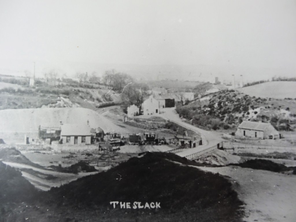
THE SLACK:
Below is a photo of The Slack, the name given to the small community at the bottom of Diamond Bank, between Butterknowle and the River Gaunless. The photo shows cottages amongst an industrial backdrop – a pit heap directly behind a cottage, the railway or tramway leading to Diamond Pit and Quarry Pit beyond, to the right of the photo, two chimneys of the engine shed to the coke works. I was told that these 2 chimneys were the brickworks but the OS map indicates an engine shed with tracks leading to the coke ovens. The village of Butterknowle lies at the top of the bank along Pinfold Lane. Stone Row can be seen along the ridge.
DIAMOND BANK
The bank leading up to the Diamond Pit, one of the collieries worked by the Butterknowle Coal Company, shows houses at the Slack and the pit head gear of the pit.
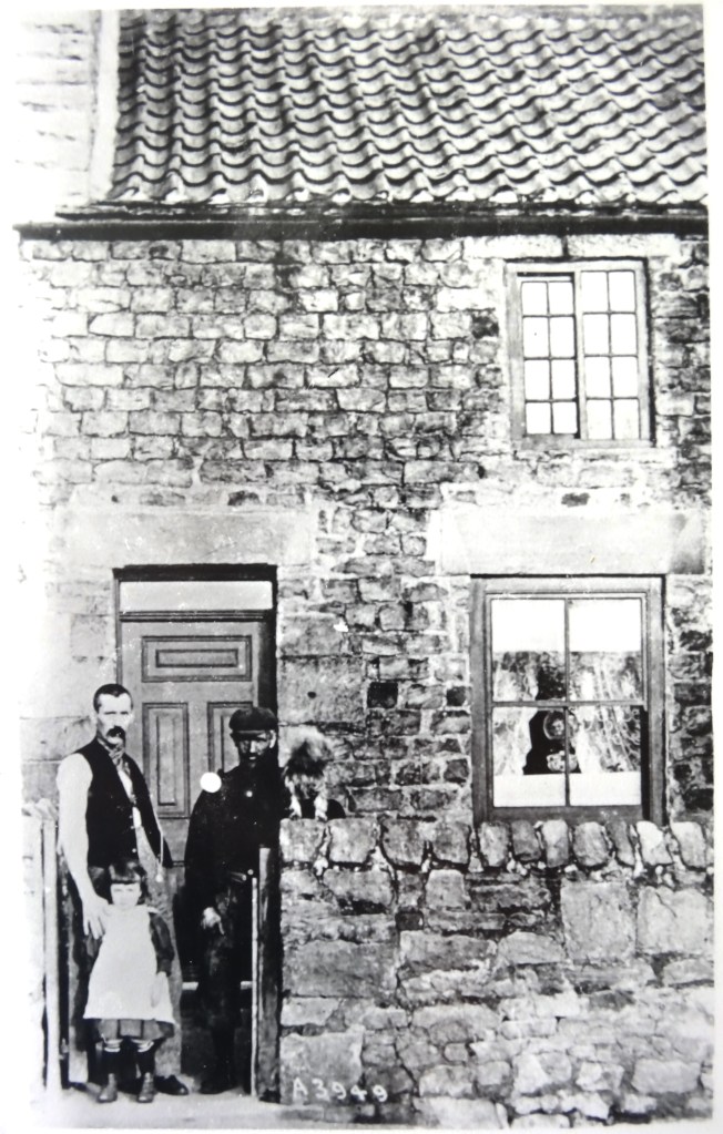
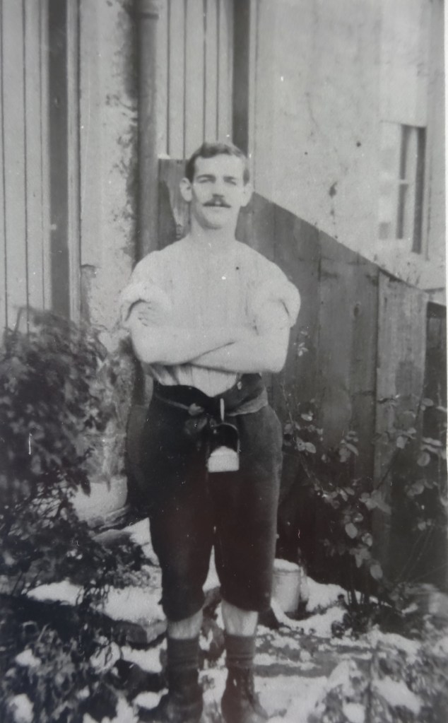
A MINERS’ HOUSE
This photo shows a pitman talking to a neighbour with his young daughter outside his home.
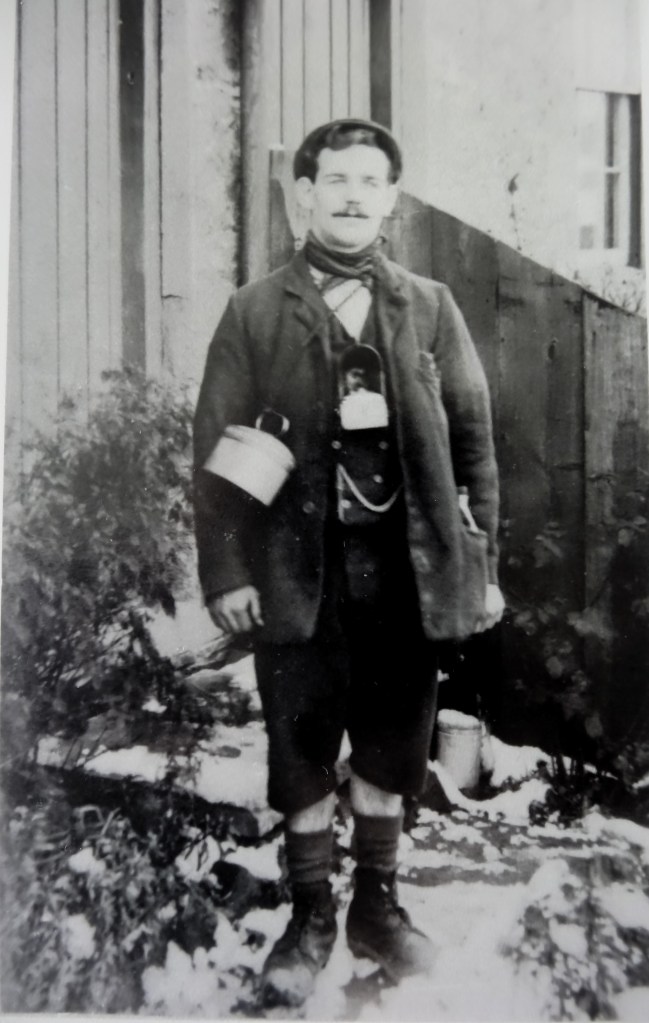
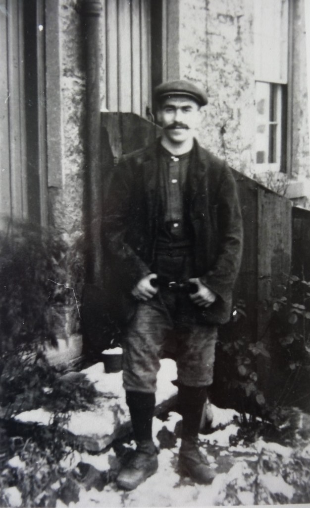
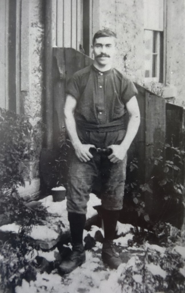
PITMEN
These men maybe outside their homes in Stone Row, Butterknowle. The other main terrace which housed miners was called Wood Row, demolished many years ago.
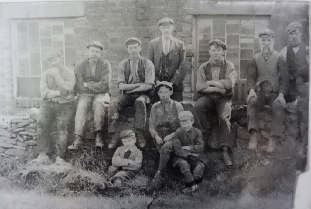
WOOD ROW MINERS (Below)
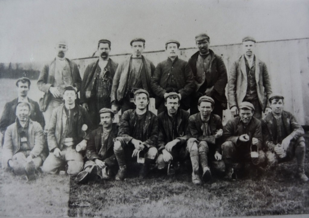
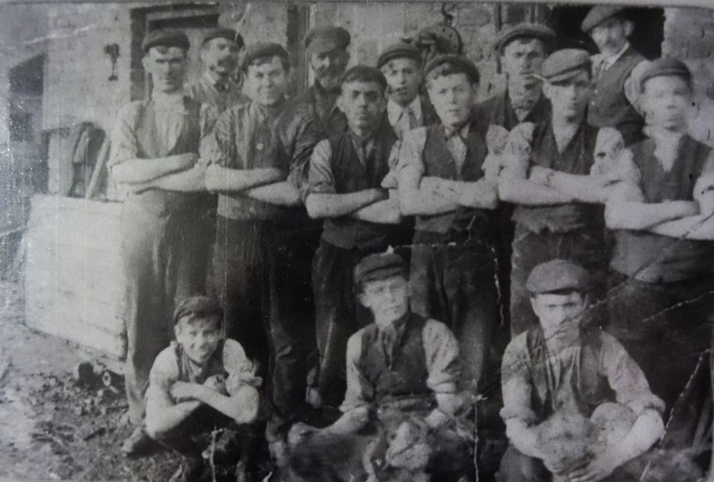
QUARRY PIT MINERS (Below)
A GROUP OF MINERS including WILLIE WOOD & MATT KELLETT (sadly, we cannot identify them)
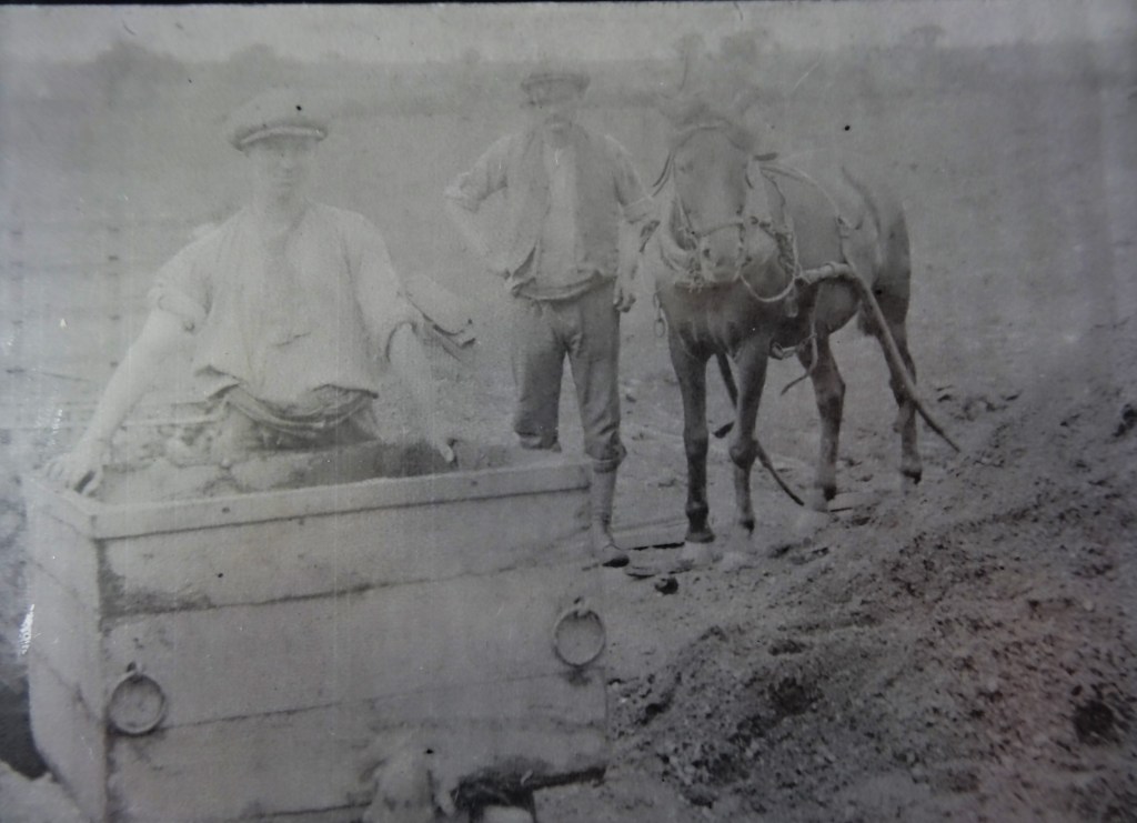
SALTERSBURN DRIFT (Below)
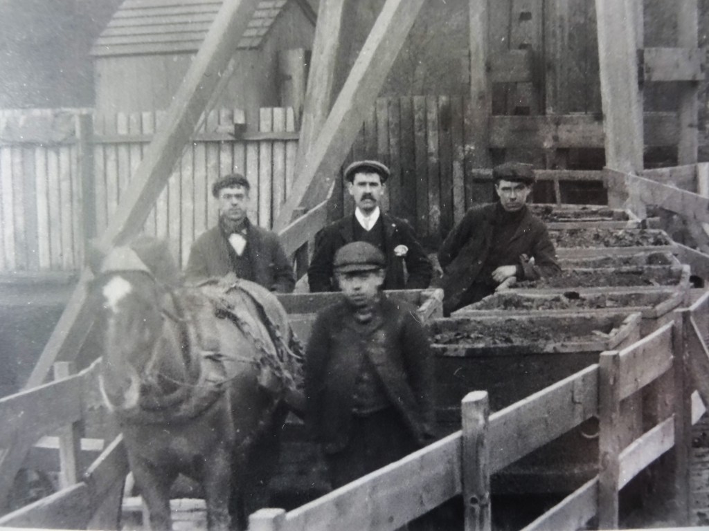
DIAMOND PIT OR MARSFIELD SCREENS (Below)
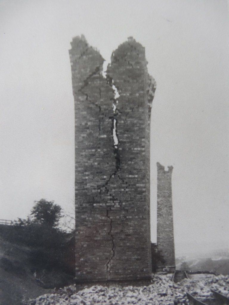
THE CHIMNEYS OF THE ABANDONED COKE OVENS IN A STATE OF DISREPAIR
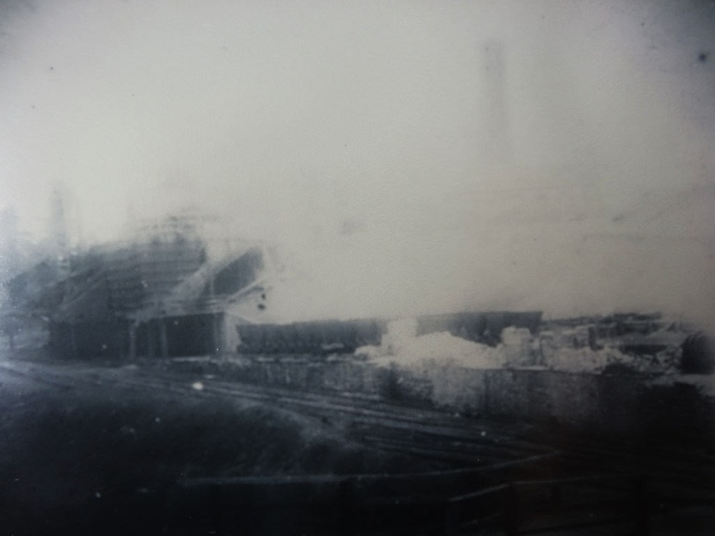
BUTTERKNOWLE COKE OVENS: It is difficult to say what is going on here!
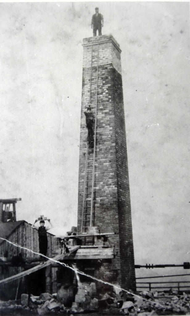
BRICKLAYERS EXTENDING A CHIMNEY (DIAMOND PIT?)
Note the health & safety requirements!
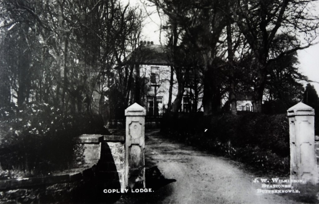
COPLEY LODGE WAS THE PIT MANAGER’S HOUSE AND COLLIERY OFFICES
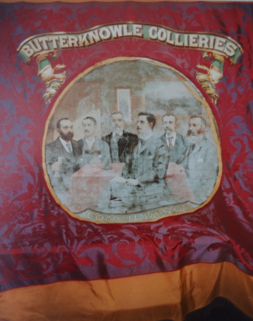
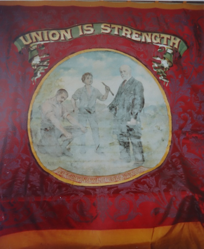
BUTTERKNOWLE COLLIERIES UNION BANNER
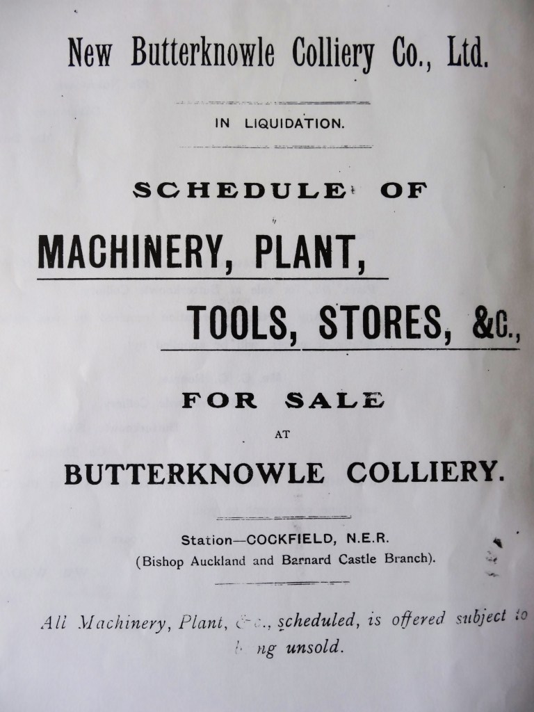
NEW BUTTERKNOWLE COLLIERY CO. LTD. LIQUIDATION SALE CATALOGUE
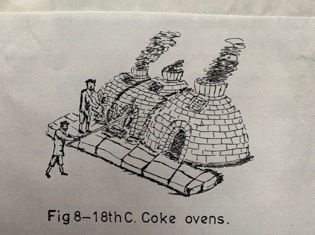
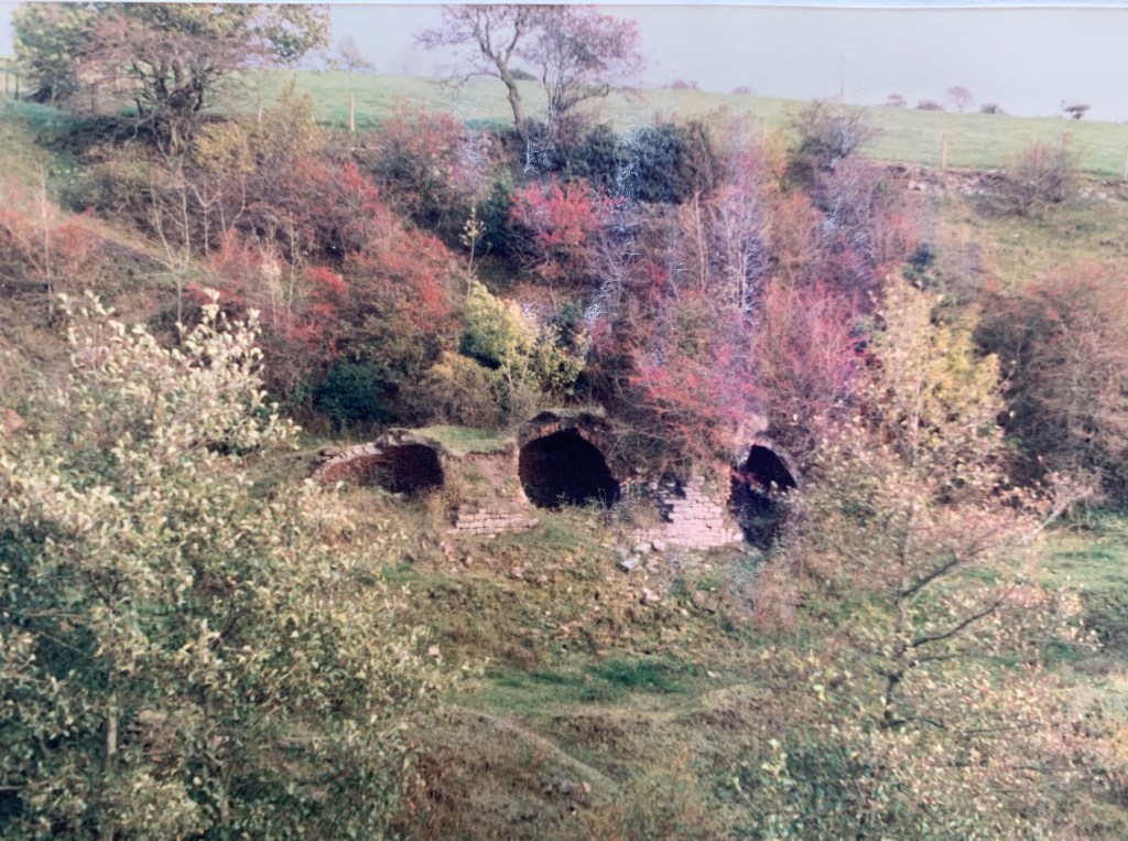
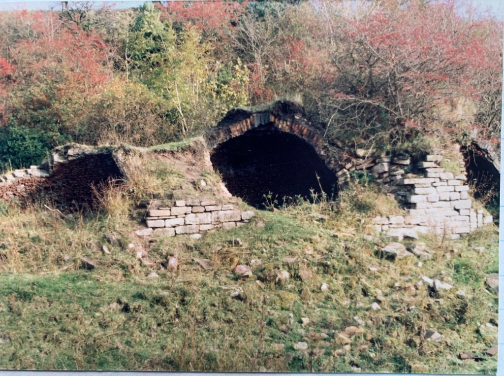
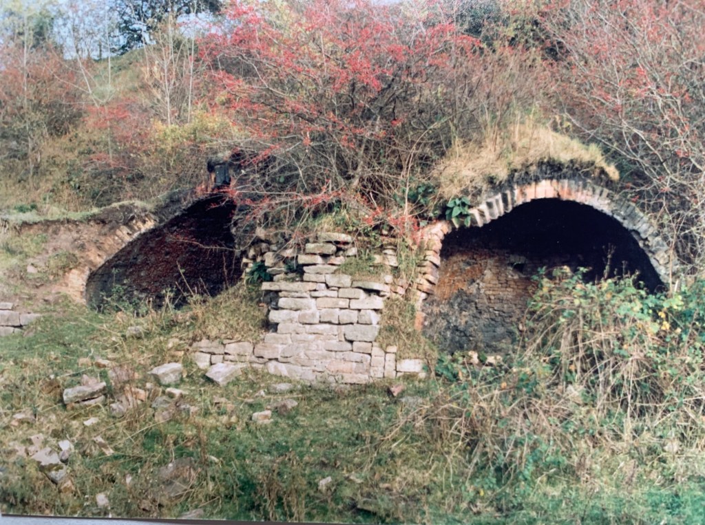
A SKETCH OF 18th C COKE OVENS AND BELOW 3 PHOTOS OF ABANDONED BEEHIVE COKE OVENS AT BUTTERKNOWLE, c.1986
BUTTERKNOWLE COLLIERY RAILWAY, QUARRY DRIFT TRAMWAY and other small scale workings around the Butterknowle and Cockfield areas.[1]
At the end of the 18th Century, the Butterknowle Royalty was leased to Robert Lodge from Barnard Castle who sublet it to Messrs. Bell and Allison who worked the coal unambitiously for landsale. The daughter and “heiress” of Robert Lodge was married to the Rev. Luke Prattman, minister of the Congregational Church at Barnard Castle, and he had more ambitious plans for the inherited Butterknowle and Copley Collieries. In 1828, Prattman assumed overall control of the collieries and production increased to 42,000 tons a year but geological problems were draining his finances. It was decided to sink the Diamond Pit but he went bankrupt in 1841, with debts of over £40,000. Prattman died in 1946. During the 1850s market conditions improved when Bolckow Vaughan purchased coke and by 1851 from newly built coke ovens. By 1854, 33 ovens at East Butterknowle Colliery were fully working and the Diamond Pit was reopened as the commercial situation improved.
The following notes will comment on mining and colliery tramways, as evidenced by the various Ordnance Survey maps.
The FIRST EDITION of the OS map, 1857 Surveyed, Published 1859:
There are 4 areas of coal workings are identified – to the south west and north west of Haggerleases Station and 2 isolated sites:
- South West, south of Copley Lane: A railway line is shown south westwards, to the south of the road and north of the River Gaunless heading in the direction of Copley Colliery (Smout Pit) but for part of the route the line is not marked therefore, was it a railway track for the whole length? A tramway links Smout Pit to a drift mine, further westwards. Further west still, there is another shaft and another colliery, both to the south of Copley Lane. To the immediate north of Copley Lane is another colliery and shaft.
- North West, west of Low Wham Farm: along Grewburn Beck is another group of small winnings. Black Diamond Colliery is indicated near Nab End, to the south of Butterknowle Lane. Butterknowle Colliery is marked and there is a shaft to the east of Crow Howle Beck.
- Wham Colliery is next to the Malt Shovel P.H. on Haggerleases Lane.
- Another unnamed colliery north west of Potters Cross.
By 1898, of the above sites, Butterknowle Collieries had expanded significantly.
1896 Revised, Published 1898, THE SECOND EDITION
There had been significant changes in the 40 years between the publication of the first 2 editions of the OS maps:
- South West: The workings to the south of Copley Lane, previously called Copley Colliery (Smout Pit) are not indicated. Along the fields bordering Copley Lane are 4 “old shafts” and 3 “air shafts.” There is a shaft to the south of the road, south west of the Stag’s Head Inn. With the exception of this shaft, this group of workings seem to have been abandoned for some time since there is little cartographical evidence of spoil heaps which does not indicate extensive industrial activity.
- North West: Butterknowle Colliery Railway follows Grewburn Beck. Gordon Pit is located to the north of the Stag’s Head Inn and south of Nab End, Diamond Pit is indicated by a shaft to the south of the road, there is a drift to the west of Nab End, there are 2 coal shafts to the south of Bleak House and the main activity is at Quarry Pit worked by a drift with spoil heaps. A second railway spur heads northwards towards another mining complex. This track travels past the brickworks, along Crow Howle Beck and a long line of coke ovens to another working named Butterknowle Colliery. It is served by 2 tramways, one to the west to Salter Burn Drift and one to the east to Wham Drift (which is near Wham Colliery identified in 1859). A third “old railway” goes northwards over the road by a viaduct to Loop Gill and up to (what may have been a drift mine) at Marsfield. There are also coal shafts and drifts at High Wham near the Methodist Chapel.
- Potters Cross: there were no further developments in this area.
There are new workings on Cockfield Fell which will be discussed in other articles. They are:
- New Copley Colliery
- Millfield Grange
- North End
- Gordon House Colliery
This progress mining development in the Butterknowle area was halted by a legal verdict when the Butterknowle Colliery Co. Ltd lost an appeal against a legal judgement relating to subsidence. The Bishop Auckland Co-operative Society, established in 1885, had property in Butterknowle. In 1902, one of its buildings suffered much damage, thought to be due to mining subsidence. The case was contested in the court, went to appeal to the House of Lords and in May 1906, a judgement was found in favour of the Coop. The Butterknowle Colliery Co. Ltd lost its case and compensation for damages was imposed upon the company. The Butterknowle Colliery Co. Ltd could not pay and subsequently went into liquidation.
In 1909, the New Butterknowle Colliery Co. Ltd was established but this new enterprise only took over Quarry Pit and not the Salter Burn, Wham and Marsfield concerns.
1919 Revised, Published 1924, THE THIRD EDITION
In the light of the above court case and its repercussions, there were major changes to the mining situation over the 26 years since the second edition OS map was published:
- The Butterknowle Railway was now known as the Quarry Drift Tramway. It followed the bed of the Grewburn Beck along to the site of Quarry Drift. In 1923, Quarry Drift Colliery Co. Ltd., 11 West View, Butterknowle owned Quarry Drift and the Diamond Colliery. George Brown was the manager. The Jubilee and Hutton seams were abandoned in 1927.
- The workings to the north i.e. the coke works, tramways and drift mines were abandoned.
There were a number of small scale drift mines operating in the Butterknowle and Cockfield Fell area which were connected to the Butterknowle Branch (renamed in 1899) by tramways. They were:
- New Morley Drift c.1921-1937: See accompanying article.
- Low Butterknowle Colliery near Jane Pit houses.
- Holly Moor Colliery: In 1923 Summersons Ltd owned the colliery and H. Summerson was manage. Seams were abandoned in 1925 Five Quarter, 1929 Five Quarter and Main and at New Holly Moor – Main and Five Quarter in 1933.
There were a number of small scale workings which used tramways but were remote from the railway. Presumably, they used horse and cart to transport their coals to the goods yard at Butterknowle, if required. Perhaps most of their coal was for household use for the local market. They were:
- Softley Cottage: The commercial name of this working is not known. It is located near Softley Cottage, west of Pinfold Lane, Butterknowle. A tramway headed in a north, north westward direction towards 2 drift mines. A third drift was located to the east of Softley Cottage.
- Rowantree House: A tramway on the opposite side of the road to Rowantree House linked 2 drift mines. There were another 2 drifts north of Rowantree House and 7 old drifts and shafts sited to the north of the tramway. In 1923, T.J. Alderson of Wham was the owner and T. Alderson was the manager. Various seams were abandoned – Brockwell in 1920 at Rowantree South, the Main seam in 1931 at Rowantree West and the Brockwell in 1925 and again in 1930. Without a close examination of the Catalogue of Abandoned Mines it is impossible to make firm conclusions when this enterprise was closed.
- Raby Moor Colliery: A tramway linked the drift mine to the depot near Burnt Houses Lane. G.H. Raine, Mount Pleasant, Cockfield was the owner and manager in 1923. Coal seams were abandoned between 1927 and 1942 – in 1927 Brockwell, 1928 Chatham and Jubilee, 1938 Harvey and 1942 Brockwell.
[1] Various editions of Ordnance Survey maps have been used to locate and describe the various coal workings in the Butterknowle and Cockfield areas.
